Snowy Valleys Council
The Snowy Valleys Council is a local government area located in the South West Slopes region of New South Wales, Australia. This area was formed in 2016 from the merger of the Tumut Shire with the neighbouring Tumbarumba Shire.[3]
| Snowy Valleys Council New South Wales | |||||||||||||||
|---|---|---|---|---|---|---|---|---|---|---|---|---|---|---|---|
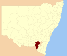 Location in New South Wales | |||||||||||||||
| Population |
| ||||||||||||||
| • Density | 1.6066/km2 (4.1610/sq mi) | ||||||||||||||
| Established | 12 May 2016 | ||||||||||||||
| Area | 8,960 km2 (3,459.5 sq mi)[3] | ||||||||||||||
| Mayor | James Hayes | ||||||||||||||
| Region | South West Slopes | ||||||||||||||
| State electorate(s) | Albury, Wagga Wagga | ||||||||||||||
| Federal Division(s) | Eden-Monaro | ||||||||||||||
| Website | Snowy Valleys Council | ||||||||||||||
| |||||||||||||||
The council area comprises 8,960 square kilometres (3,460 sq mi) and covers the western side of the southern-most portion of the Great Dividing Range and foothills in New South Wales. Large sections of the local government area are contained within national parks. At the time of its establishment, the population in the council area was estimated to be 14,953.[3]
Mayor of Snowy Valleys Council is Councillor James Hayes, who was elected unopposed after the inaugural Snowy Valleys Council election which was held on 9 September 2017.[4]
Main towns and villages
In addition to the towns of Adelong, Batlow, Tumbarumba and Tumut, localities in the area include Brindabella, Brungle, Cabramurra, Gilmore, Grahamstown, Gocup, Jingellic, Khancoban, Killimicat, Little River, Maragle, Rosewood, Talbingo, Tooma, Wondalga and Yarrangobilly.
Heritage listings
The Snowy Valleys Council has a number of heritage-listed sites, including:
- Mount Kosciuszko to Eden: Bundian Way[5]
- Tumut, Adelong Falls Gold Workings[6]
- Tumut, Cootamundra-Tumut railway: Tumut railway station[7]
- Tumut, 46 Russell Street: Montreal Community Theatre[8]
- Tumut, Tumut Plains Road: Junction Bridge, Tumut[9]
Demographics
Council
Snowy Valleys Council consists of nine Councillors elected proportionally as a single ward. All Councillors are elected for a fixed four-year term of office with effect from 9 September 2017.[3]
References
- Australian Bureau of Statistics (27 June 2017). "SNowy Valleys (A)". 2016 Census QuickStats. Retrieved 8 December 2017.

- "3218.0 – Regional Population Growth, Australia, 2017-18". Australian Bureau of Statistics. 27 March 2019. Retrieved 27 March 2019. Estimated resident population (ERP) at 30 June 2018.
- "Snowy Valley Council". Stronger Councils. Government of New South Wales. 12 May 2016. Retrieved 13 May 2016.
- "Meet Your Councillors". Snowy Valleys Council. Retrieved 30 September 2017.
- "Bundian Way". New South Wales State Heritage Register. Office of Environment and Heritage. H01906. Retrieved 18 May 2018.
- "Adelong Falls Gold Workings/Reserve". New South Wales State Heritage Register. Office of Environment and Heritage. H00072. Retrieved 18 May 2018.
- "Tumut Railway Station group". New South Wales State Heritage Register. Office of Environment and Heritage. H01273. Retrieved 18 May 2018.
- "Montreal Community Theatre and Moveable Heritage Collection". New South Wales State Heritage Register. Office of Environment and Heritage. H01909. Retrieved 18 May 2018.
- "Junction Bridge". New South Wales State Heritage Register. Office of Environment and Heritage. H01471. Retrieved 18 May 2018.