Van Buren Township, Pulaski County, Indiana
Van Buren Township is one of twelve townships in Pulaski County, Indiana, United States. As of the 2010 census, its population was 911 and it contained 386 housing units.[1]
Van Buren Township | |
|---|---|
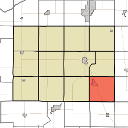 Location in Pulaski County | |
| Coordinates: 40°57′22″N 86°31′48″W | |
| Country | USA |
| State | Indiana |
| County | Pulaski |
| Government | |
| • Type | Indiana township |
| Area | |
| • Total | 36.28 sq mi (94.0 km2) |
| • Land | 36.28 sq mi (94.0 km2) |
| • Water | 0 sq mi (0 km2) 0% |
| Elevation | 725 ft (221 m) |
| Population (2010) | |
| • Total | 911 |
| • Density | 25.1/sq mi (9.7/km2) |
| ZIP codes | 46978, 46985 |
| GNIS feature ID | 453951 |
Van Buren Township was organized in 1842, and named for Martin Van Buren (1782–1862), eighth President of the United States (1837–1841).[2]
Geography
According to the 2010 census, the township has a total area of 36.28 square miles (94.0 km2), all land.[1]
Cities, towns, villages
Unincorporated towns
(This list is based on USGS data and may include former settlements.)
Adjacent townships
- Harrison Township (north)
- Union Township, Fulton County (northeast)
- Wayne Township, Fulton County (east)
- Harrison Township, Cass County (southeast)
- Boone Township, Cass County (south)
- Cass Township, White County (southwest)
- Indian Creek Township (west)
- Monroe Township (northwest)
Cemeteries
The township contains these four cemeteries: Buck, Independent Order of Odd Fellows (now known as Star City West Cemetery), Mull and Victor Chapel.
Major highways
Education
- Eastern Pulaski Community School Corporation
Van Buren Township residents may obtain a free library card from the Pulaski County Public Library in Winamac.[3]
Political districts
- Indiana's 2nd congressional district
- State House District 16
- State Senate District 18
References
- United States Census Bureau 2008 TIGER/Line Shapefiles
- United States Board on Geographic Names (GNIS)
- IndianaMap
- "Population, Housing Units, Area, and Density: 2010 - County -- County Subdivision and Place -- 2010 Census Summary File 1". United States Census. Archived from the original on 2020-02-12. Retrieved 2013-05-10.
- Counties of White and Pulaski, Indiana: Historical and Biographical. F.A. Battey & Company. 1883. p. 588.
- "The Library District". Pulaski County Public Library. Retrieved 14 March 2018.
External links
Places adjacent to Van Buren Township, Pulaski County, Indiana | |
|---|---|
Municipalities and communities of Pulaski County, Indiana, United States | ||
|---|---|---|
| Towns | Map of Indiana highlighting Pulaski County | |
| Townships | ||
| CDP | ||
| Other unincorporated communities | ||
This article is issued from Wikipedia. The text is licensed under Creative Commons - Attribution - Sharealike. Additional terms may apply for the media files.