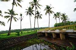
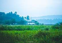
Kottakkal
Kottakkal (literally-Land of the Fort) is a municipal town in Malappuram district in Kerala, southern India having 32 wards. It is located 12 km (7.5 mi) southwest of Malappuram, the district headquarters, and 14.5 km (9.0 mi) from Tirur Railway Station.
Kottakkal | |
|---|---|
Municipality | |
 Kottakkal Bypass | |
 Kottakkal Location in Kerala, India  Kottakkal Kottakkal (India) | |
| Coordinates: 10.94015°N 76.00147°E | |
| Country | |
| State | Kerala |
| District | Malappuram |
| Government | |
| • Chairman | KK Nazar |
| Languages | |
| • Official | Malayalam, English |
| Time zone | UTC+5:30 (IST) |
| PIN | 676503 |
| Telephone code | 91483 |
| Vehicle registration | KL-10, KL-55, KL-65 |
The National Highway 66 separates the municipality from Edarikode grama panchayat on some parts to the west.[1] However, the fast developing Kottakkal urban area is now spread up to different parts of neighboring panchayats such as Edarikode.
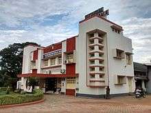
Kottakkal is known for its ayurvedic heritage, Arya Vaidya Sala, Kottakkal is a world renowned institute offering medical treatment, Research and Manufacturing of Medicines out of Ayurveda. Adding to the cultural heritage, Kottakkal Pooram, The popular temple festival, is being celebrated over seven days during March–April months.[2]
History
Kottakkal, formerly known as "Sweta Durgam" (the White Fort) in Sanskrit, "Venkalikotta" and "Venkitta Kotta" in Malayalam, was a military base of the Kingdom of Valluvanadu in the medieval period. It was under the control of the Karuvayoor Moosad, the chief marshal and preacher of the Moopil Nairs. It may be the forts and castles constructed by the Karuvayoor Moosad that were the origin of the name "Kottakkal". The suburbs of Kottakkal were known as Changuvettikkadu and Eyyakkadu (now Changuvetti is developing as a twin town to Kottakkal).
Municipal elections
The United Democratic Front won the first elections (held in October 2010) to the Kottakkal municipality.[3] K. K. Nazar and Paroli Moosakutty Haji of Indian Union Muslim League were elected as the Chairperson and Vice-Chairman respectively of the municipality.[4] Other major Political representatives in the Municipality include TP Subair and Nani of Left Democratic Front.
Notable personalities
- K C Manorama Thampuratti (eminent Sanskrit poet)
- K. C. Manavedan Raja (founder of Raja's High School, Zamorin of Calicut during 1932-1937)
- M. K. Vellodi (Indian civil servant, diplomat, former Cabinet Secretary)
- Dr. K. C. K. E Raja, former Vice Chancellor Kerala University and Director General of Health Services.
- U. A. Beeran
- P.S.Varier (founder of Kottakkal Arya Vaidya Sala)
- P. K. Warrier
- Kottakkal Sivaraman (eminent Kathakali artist)
- Kottakkal Madhu (Kathakali singer)
- M. P. Abdussamad Samadani (politician, MLA, former Member of Parliament)
Basic information of Kottakkal Municipality
| Area | 20.43 km2 (7.89 sq mi) |
| Wards | 32 |
| Taluk | Tirur, Tirurangadi |
| City | Kottakkal |
| Assembly Constituency | Kottakkal |
| Loksabha Constituency | Ponnani |
| Vehicle Registration No. | KL-55, KL-10 & KL-65 |
| Neighbouring Panchayaths | Edarikode, Parappur, Othukkungal, Ponmala and Marakkara |
| Post Offices | Kottakkal, Puthoor, Indianoor, Pathayakkallu, Kuttippuram, Pandamangalam, |
| Pincodes | 676501, 676503, 676508 |
Transportation
- Bus services: Kottakkal Bus station at the heart of the town,links to all rural bus services around Kottakkal locality and Long route services connecting nearby towns like Manjeri, Malappuram, Perinthalmanna etc. KSRTC service also available.
- Railway Station: Tirur Railway Station is one of the major railway stations in the Malabar region. Almost every train stops here, connecting the Malappuram district to the rest of the country. It is located 14 km away from the Kottakkal town. Passengers from kottakkal can also access Angadippuram railway station which is about 26 km from kottakkal town.
- Nearest Airport: Calicut International Airport is approximately 25 kilometres away.
Nearby places
- Vengara, Oorakam, Cherukulamba, Puthuparamba and Edarikode
- Indianoor, Kavathikalam, Marakkara, Maravattam, Kadampuzha, Puthur, Padapparamba, Chattiparamba
- Pang, Parappur, Pottippara, Venniyoor and Vettichira
See also
- Kottakkal (State assembly constituency)
References
- https://web.archive.org/web/20110129234527/http://www.exoticindiaart.com/book/details/IDC162/
- "Kottakkal Arya Vaidya Sala". Retrieved 18 December 2012.
- "Archived copy". Archived from the original on 28 October 2010. Retrieved 28 October 2010.CS1 maint: archived copy as title (link)
- The Hindu : Kerala / Malappuram News : Municipalities get new chiefs
External links
- Kottakkal in Wikimapia
- Kottakkal Municipality
- Documentary on Arya Vaidya Sala in Malayalam - https://www.youtube.com/watch?v=IuPbz-etmMI
| Wikimedia Commons has media related to Kottakkal. |