Kalpetta
Kalpetta is a town and a municipality in the Wayanad district, state of Kerala, India. Kalpetta is the headquarters of Wayanad district[1] as well as the headquarters of Vythiri taluk.[2] It is a bustling town surrounded by dense coffee and tea plantations and mountains. It lies on the Kozhikode-Mysore National Highway NH 766 (Formarly NH 212) at an altitude of about 780 m above sea level. Kalpetta is 72 km from Kozhikode and 140 km from Mysore.
Kalpetta | |
|---|---|
Municipality | |
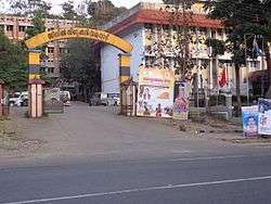 Kalpetta Civil Station complex entrance in December, 2013 | |
 Kalpetta Location in Kerala, India  Kalpetta Kalpetta (India) | |
| Coordinates: 11.622550°N 76.081252°E | |
| Country | |
| State | Kerala |
| District | Wayanad |
| Area | |
| • Total | 40.74 km2 (15.73 sq mi) |
| Elevation | 780 m (2,560 ft) |
| Population (2011) | |
| • Total | 90,491 |
| • Density | 2,200/km2 (5,800/sq mi) |
| Languages | |
| • Official | Malayalam, English |
| Time zone | UTC+5:30 (IST) |
| PIN | 673121 (Kalpetta Head PO), 673122 (Kalpetta North) |
| Telephone code | +91 4936 |
| Vehicle registration | KL-12 |
Apart from the administrative capital of the district, Kalpetta is also the centre of tourism activities in Wayanad due to its central location within the district and its proximity to most visited tourist sites. There is a good number of hotels and resorts within and surrounding Kalpetta town.
Etymology
It is believed that the early Jain residents who migrated from Karnataka have named the place "Kalpetta". In Dravida, the words "Kal" and "Pettah" means "deposits of stones". Rocks -large and small- are found throughout the landscape of Kalpetta. Hence this name was derived.
History

Kalpetta was under the rule of Western Ganga dynasty until AD930. Through ages this region fell into the rule of Hoysala Empire, Vijayanagara Empire, and Kingdom of Mysore. Pazhassi Raja was the next to rule the region. Kalpetta Nair administered the place as the representative for Pazhassi Raja. Mysorean invasion of Kerala made Kalpetta a part of Tipu Sultan's empire. This continued until the demise of Tipu Sultan. Along with the rest of Malabar, Kalpetta also came under British rule after Tipu Sultan's demise.
In Wayanad, the Indian independence movement started first at Kalpetta. The first political conference was held in 1921 under the leadership of Dharmaraja Iyer. K. P. Kesava Menon and A. K. Gopalan participated in this meeting. Formation of the committee of Indian National Congress also occurred around the same time. Father of the nation, Mahatma Gandhi visited Kalpetta on 1934 January 14.[3]
Kalpetta became the headquarters when Wayanad district was formed on 1 November 1980. Kalpetta was still a Village Panchayath when it became district headquarters and it attained Municipality status on 1 April 1990.
Demographics
As of 2011 India census,[4] Kalpetta had a population of 90491 . Males constitute 49% of the population and females 51%. In Kalpetta, 11% of the population is under the age of 6.
People
Being the district headquarters, Kalpetta is home to a large number of government offices. Besides, the district level offices of Media Houses, Political Parties etc. also function out of Kalpetta. Hence a large section of the population of Kalpetta are office-goers. Like elsewhere in Kerala, Hindus, Muslims and Christians live in harmony in Kalpetta. There is a significant Jain population also in Kalpetta.
Transport
Kalpetta has very good road connectivity with the rest of Kerala and neighbouring South Indian cities. NH766 connects Kalpetta with Kozhikode and Mysore. State Highways connect Kalpetta with Ooty in Tamil Nadu and Madikeri in Karnataka. En route to Mysore on NH 766, past Wayanad district boundary, which is also the Kerala state boundary, NH 766 passes through Bandipur National Park. There is a night traffic ban imposed on this stretch since 2009.[5] The alternate road to take is, leave NH 766 at Kalpetta and proceed to Mysore through Mananthavady, Kutta, Gonikoppal, and Hunsur.
The nearest airport is Calicut International Airport, 100 km from Kalpetta. Kannur international airport is 110 km from Kalpetta
Tourist attractions
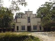
- Mahathma Gandhi Museum
- Myladippara trekking center
- Pookode Lake
- Meppadi Garden village
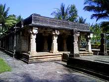
- Anantnath Swami Temple
- Lakkidi View Point
- Chembra Peak
- Soochipara Falls
Economy
The Wayanad dairy of Milma (Kerala Co-operative Milk Marketing Federation) is situated at Chuzhali within Kalpetta Municipal Limits. There is a Mini Industries Park promoted by Kinfra at Kalpetta. Several small scale industries function out of this Park. Tourism and hospitality industry experienced a boom in recent years. This has led to mushrooming of resorts throughout Wayanad, with the largest concentration of hotels and resorts at Kalpetta and adjoining areas within Vythiri taluk.
Education
- Kerala Veterinary and Animal Sciences University, Pookode (14 km from Kalpetta)
- College of Veterinary and Animal Sciences at Pookode (14 km from Kalpetta)
- Oriental School of Hotel Management located at Lakkidi (15 km from Kalpetta)
- DM WIMS Medical College located at Meppadi (15 km) is the only Medical College in Wayanad district
- College of Dairy Science and Technology, Pookode offers B.Tech degree course in Dairy Science & Technology
- DM WIMS Nursing College located at Meppadi
- Kendriya Vidyalaya, Kalpetta
- SKMJ Higher Secondary School, Kalpetta
- De Paul Public School, Kalpetta
- NSS Higher Secondary School, Kalpetta
- Govt.College, Vellaramkunnu, Kalpetta.
- St: Joseph's Convent School, Kalpetta.
- Jawahar Navodaya, Kalpetta
- M.S. Swaminathan Research Foundation, Kalpetta
- NMSM Government College
Renowned personalities
- Midhun Jith- Indian Team player /Guinness World Record Breaker & World Kickboxing Champion
- Abu Salim - actor
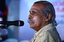
- M. P. Veerendra Kumar - writer and politician
- Anu Sithara - Actress
- Sunny Wayne - Actor
- Midhun Manuel Thomas - Script writer and Director
Climate
| Climate data for Kalpetta, Kerala | |||||||||||||
|---|---|---|---|---|---|---|---|---|---|---|---|---|---|
| Month | Jan | Feb | Mar | Apr | May | Jun | Jul | Aug | Sep | Oct | Nov | Dec | Year |
| Average high °C (°F) | 27.2 (81.0) |
28.8 (83.8) |
30.4 (86.7) |
30.4 (86.7) |
29.4 (84.9) |
25.9 (78.6) |
24.4 (75.9) |
25.1 (77.2) |
26.0 (78.8) |
26.6 (79.9) |
26.5 (79.7) |
26.5 (79.7) |
27.3 (81.1) |
| Average low °C (°F) | 16.7 (62.1) |
17.9 (64.2) |
19.5 (67.1) |
20.8 (69.4) |
20.8 (69.4) |
19.7 (67.5) |
19.3 (66.7) |
19.4 (66.9) |
19.2 (66.6) |
19.4 (66.9) |
18.6 (65.5) |
17.0 (62.6) |
19.0 (66.2) |
| Average precipitation mm (inches) | 4 (0.2) |
10 (0.4) |
19 (0.7) |
99 (3.9) |
210 (8.3) |
664 (26.1) |
1,229 (48.4) |
637 (25.1) |
275 (10.8) |
239 (9.4) |
92 (3.6) |
24 (0.9) |
3,502 (137.8) |
| Source: Climate-Data.org[6] | |||||||||||||
See also
- Chundale town
- Meppadi town
- Muttil, Kalpetta
- Vythiri
References
- "Kalpetta". india9. Retrieved 14 October 2006.
- Taluks of Kerala
- "Kalpetta History". kalpettamunicipality. Retrieved 29 January 2014.
- "Kalpetta Census 2011 data". censusindia. Retrieved 29 January 2014.
- "Bandipur-road-to-be-closed-at-night". DNA India. Retrieved 11 May 2014.
- "CLIMATE: KALPETTA", Climate-Data.org. Web: .
External links
| Wikimedia Commons has media related to Kalpetta. |

| History of Wayanad |
| ||||
|---|---|---|---|---|---|
| Cities | |||||
| Transport |
| ||||
| Education in Wayanad |
| ||||
| Visitor attractions | |||||
| Places of worship |
| ||||
| Other topics | |||||
| |||||