Alappuzha
Alappuzha (![]()
Alappuzha Alleppey | |
|---|---|
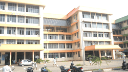
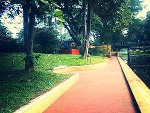
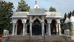
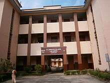
 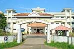 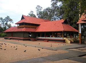  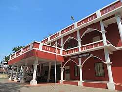 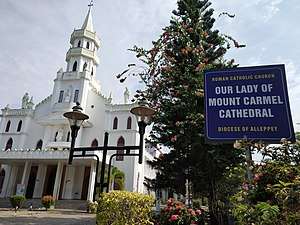 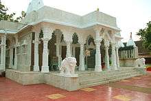 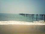 from left to right: Boating centre, Government college of Nursing, Mullakkal Temple, Town Square, Alappuzha, Alappuzha District court, Roman Catholic Diocese of Alleppey(Latin Church), Jain temple, Alleppey, Alappuzha Beach, | |
 Alappuzha  Alappuzha | |
| Coordinates: 9.49°N 76.33°E | |
| Country | |
| State | Kerala |
| Region | Central Travancore |
| District | Alappuzha District |
| Government | |
| • Type | Municipality |
| • Body | Alappuzha |
| • Municipal Chairman | Ellickal Kunjumon |
| Area | |
| • Total | 46.20 km2 (17.84 sq mi) |
| Elevation | 11 m (36 ft) |
| Population (2011) | |
| • Total | 174,164 |
| • Rank | 6th |
| • Density | 3,800/km2 (9,800/sq mi) |
| Demonym(s) | Venice of the East |
| Languages | |
| • Official | Malayalam, English |
| Time zone | UTC+5:30 (IST) |
| PIN | 688001 |
| Telephone code | 0477 |
| Vehicle registration | KL-04 |
| Sex ratio | 1079 ♂/♀ |
| Website | alappuzha |
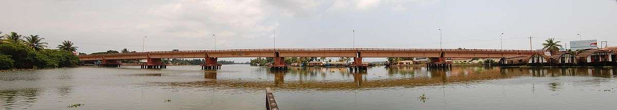
The city is situated 28 km from Changanacherry, 46 km from Kottayam, 53 km from Kochi, 129.4 km from Thrissur and 155 km north of Trivandrum.[4] A town with canals, backwaters, beaches, and lagoons, Alappuzha was described by Lord Curzon as the "Venice of the East." Hence, it is known as the "Venetian Capital" of Kerala. In Alappuzha, Malayalam is the most spoken language.
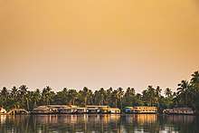
It is an important tourist destination in India.[5] The Backwaters of Alappuzha is one of the most popular tourist attractions in Kerala which attracts millions of domestic and international tourists to the district and employs vast number of locals in the private sector. A houseboat cruise in these backwaters can be booked.[6] It connects Kumarakom and Cochin to the North and Quilon to the South. Apart from houseboat services, the Kerala State Water Transport Department provides government boat services within the district and Quilon (Kollam) which considers the best and cheapest way to explore the Backwaters of Alleppey.
It is also the access point for the annual Nehru Trophy Boat Race, held on the Punnamada Lake, near Alappuzha, on the second Saturday of August every year. This is the most popular and competitive boat races in India.[7] Mullackal Chirap is the major Temple Festival of Alapuzha which is held for ten days every year in end of December.
Other attractions in Alappuzha are Alappuzha Beach, offering a views of the Laccadive Sea, Pathiramanal , Ambalappuzha Sri Krishna Temple, St. Andrew's Basilica, Arthunkal, Mannarasala Temple, Cheriyanad Sree Bhalasubhramanya Swamy TempleChettikulangara Devi Temple, Haripad Sree Subrahmanya Swamy temple, Krishnapuram Palace, Thakazhy Sree Dharma Sastha Temple, Mullakkal Temple, Padanilam Parabrahma Temple, Edathua Church, Alappuzha CSI Christ Church (oldest Anglican church in Central Kerala) and Champakulam Valia PalliVetticode Sree Nagaraja Seamy Temple(Vetticode-The first and old Nagaraja Temple).
Alappuzha is home to the Punnapra-Vayalar uprising against the British and also the revolt against the Feudal raj. Communist Party members were killed by the army of the Diwan, 200 people at Punnapra on 24 October 1946 and more than 150 at Vayalar on 27 October 1946. The total loss of life is allegedly estimated to be more than a thousand.[8] Coir is the most important commodity manufactured in Alappuzha.[9] The Coir Board was established by the Central Government under the provisions of the Coir Industry Act, 1955. A Central Coir Research Institute is located at Kalavoor.[10]
Etymology
Carved out of the erstwhile Kottayam and Quilon districts, Alappuzha district was formed on 17 August 1957 and consisted initially of seven taluks, namely Cherthala, Ambalappuzha, Kuttanad, Thiruvalla, Chengannur, Karthikappally and Mavelikkara.[12]
The name Ᾱlappuzha is a toponym. ‘Ᾱlayam’ means ‘home’ and ‘puzha’ according to Dr. Herman Gundert's dictionary, means ‘watercourse’ or ‘river’. The name refers to the network of waterways and backwaters that Alappuzha and surrounding areas. The district is bounded on the north by Kochi and Kanayannur taluks of Ernakulam district, on the east by Vaikom, Kottayam and Changanassery taluks of Kottayam district and Thiruvalla and Kozhencherry taluks of Pathanamthitta district, on the South by Kunnathur and Karunagappally taluks of Kollam district and on the west by Laccadive Sea.[13]
The present Alappuzha district comprises six taluks, namely Cherthala, Ambalappuzha, Kuttanad, Karthikappally, Chengannur and Mavelikkara.[14] The area of the district is 1,414 km2 (546 sq mi). The district headquarters is located at Alappuzha.
History
In the early first decade of the 20th century the Viceroy of the Indian Empire, Lord Curzon made a visit in the State to Alleppey, now Alappuzha. Fascinated by the scenic beauty of the place, he exclaimed,
Here nature has spent up on the land her richest bounties. Alleppey, the Venice of the East.[15]
Kuttanad, the rice bowl of Kerala, with its paddy fields, small streams and canals with lush green coconut palms, was well known even from the early periods of the Sangam age.[16] History says Alappuzha had trade relations with Greece and Rome in the Middle Ages.
The early Cheras, who had their home in Kuttanad, were called `Kuttuvans`, so named after this place. Pliny and Ptolemy of the 1st and 2nd centuries had mentioned places like Purakkad or Barace in their classical works.
Literary works like "Unnuneeli Sandesam" give some insight into the ancient period of this district. Archaeological antiquities, such as the stone inscriptions, historical monuments found in the temples, churches, and rock-cut caves, also emphasise the historic importance of Alappuzha District. Christianity had a foothold in this district, even from the 1st century AD. The church located at Kokkamangalam was one of the seven churches founded by St. Thomas, one of the twelve disciples of Jesus Christ. It is generally believed that he landed at Maliankara in Muziris Port, presently known as Cranganore or Kodungallur, in 52 AD and preached Christianity in South India.
The district flourished in religion and culture under the second Chera Empire, during 9th to 12th centuries AD. The literary work, `Ascharya Choodamani`, a Sanskrit drama written by Sakthibhadran, a scholar of Chengannur, enables us to know many pertinent facts. Further, the temple on Lord Ayyappan, in Mukkal vattam near Muhamma in Alappuzha District, is called Cheerappanchira, for the Kalari from which Lord Ayyappa learnt his martial arts. A recent album by P. Unni Krishnan on Lord Ayyappa, titled 'Sabarimalai Va Charanam Solli Va', has songs illustrating the history of this temple and Lord Ayyappa's stay here before he went to conquer the Mahishi Demon.[17]
Since landing in Calicut in 1498, the Portuguese started playing an influential role in Alappuzha. They began by spreading Catholicism and converting already existing Christians into Catholics. The famous St. Andrew's Basilica was built by them during this period.[18] In the 17th century, as the Portuguese power declined, the Dutch gained a predominant position in the principalities of this district. They built many factories and warehouses for storing pepper and ginger, relying on several treaties signed between the Dutch and the Rajas of Purakkad, Kayamkulam and Karappuram. In course of time they also delved into the political and cultural affairs of the district. At that time Maharaja Marthanda Varma (1706–1758), who was the 'Maker of modern Travancore', intervened in the political affairs of those princedoms.
Travancore Dewan Ramayyan Dalawa (d. 1756) resided in Mavelikkara where he had a palace built by Marthanda Varma. After the death of his wife, Ramayyan consorted with a Nair lady from Mavelikkara of the Edassery family (PGN Unnithan, a member of this family, later became the last Dewan of Travancore in 1947). After his death Ramayyan's descendants left Travancore to settle in Pudukkottai in Tamil Nadu. His Nair consort was given gifts and presents and special allowances from the Travancore government in recognition of his services to the state while his own descendants were bestowed with the honorific title of Dalawa.
In the 19th century the district saw progress in many spheres. One of the five subordinate courts opened in the state in connection with the reorganisation of the judicial system by Colonel George Monro was located at Mavelikkara. The first post office and first telegraph office in the former Travancore state were established in this district. The first manufacturing factory for the coir mats was established in 1859. In 1894 the city Improvement Committee was set up.
The district played a role in the freedom struggle of the country. The struggles of Punnapra and Vayalar in 1946 arrayed the people against Sir C. P. Ramaswami Iyer, who was Dewan of Travancore. This led to Ramaswami Iyer's exit from the political scene of Travancore. A popular Ministry was formed in Travancore on 24 March 1948 after India's independence. Travancore and Cochin states were integrated on 1 July 1949. This arrangement continued until the formation of Kerala State on 1 November 1956, under the States Reorganisation Act 1956. The district came into existence as a separate administrative unit on 1 August 1957.
Raja Kesavadas and Alappuzha
Raja Kesavadas, the Dewan of Travancore during the reign of Dharma Raja Karthika Thirunal Rama Varma in 18th century was well known for his planning skills and administrative acumen. He was the master mind in developing the Alappuzha town.
He found Alappuzha as an ideal location and constructing a well planned port city in Travancore. Alappuzha was most suitable, because of the geographical and oceanic reasons. He constructed two parallel canals for bringing goods to port from backwaters and offered infrastructural facilities to merchants and traders from Surat, Mumbai and Kutch to start industrial enterprises, trading, and cargo centres. Alappuzha attained progress and became the financial nerve centre of Travancore during his time.[19] The port was opened in 1762, mainly for the export of coir-matting and coir-yarn. Kesavadas built three ships for trade with Calcutta and Bombay, and alleppey afforded a convenient depot for the storage and disposal of goods produce in the east.[20]
Geography
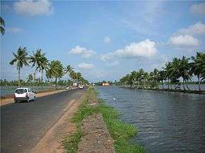
Alappuzha is located at 9.54°N 76.40°E.[21] The average elevation is 1 metre (3.3 ft)[22] Alappuzha covers an area of 1,414 square kilometres (546 sq mi) and is flanked by 2,195 square kilometres (847 sq mi) of Vembanad Lake, where six major rivers spread out before joining the 80 km coast line of the district. The city of Alappuzha is crisscrossed by a system of canals, which is a part of the National Waterway 3 (India).[23]
The district is a sandy strip of land intercepted by lagoons, rivers and canals. There are no mountains or hills in the district except some scattered hillocks lying between Bharanikkavu and Chengannur blocks in the eastern portion of the district. There are no forest area in this district.
Alappuzha is bounded by the Laccadive Sea on its west. The town has a network of lakes, lagoons and fresh water rivers. The richness of the coastal Alappuzha waters is expressed annually in the blooming and consequent deposit of a huge quantity of fishes and prawns on the Alappuzha coast called ‘[Chakara]’. This annual shifting of sandbank appears during the post-monsoon period and contributes to the local economy and is a festive season for the people of Kerala. The annual floods rejuvenate and cleanse the soil and water due to which there is abundance of marine life like prawns, lobsters, fishes, turtles, and other flora in the sea.
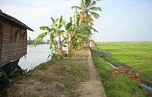
The backwaters and wetlands host thousands of migrant common teal, ducks and cormorants every year who reach here from long distances. A major feature of the area is the region called Kuttanad, the 'granary of Kerala'. Kuttanad is also known as the rice bowl of Kerala and is one of the few places in the world where farming is done below sea level. The paddy fields lie about 0.6 to 2 m below mean sea level.[24]
Climate
Owing to its proximity to the sea, the climate of Alappuzha is humid and hot during the summer, although it remains fairly cool and pleasant during the months of October and November. The average monthly temperature is 27 degree Celsius. The district gets the benefit of two seasonal monsoons, as in other parts of the state. Alappuzha town experiences a long monsoon season with heavy showers as both the Southwest monsoon and Northeast monsoon influences the weather of Alappuzha. The South-west monsoon affects the climate in the months from June to September. On the other hand, the North-east monsoon brings rain from October to November. The average rainfall received by the region is 2763 mm.[25]
| Climate data for Alappuzha (1981–2010, extremes 1944–2012) | |||||||||||||
|---|---|---|---|---|---|---|---|---|---|---|---|---|---|
| Month | Jan | Feb | Mar | Apr | May | Jun | Jul | Aug | Sep | Oct | Nov | Dec | Year |
| Record high °C (°F) | 36.7 (98.1) |
37.4 (99.3) |
37.9 (100.2) |
38.2 (100.8) |
36.7 (98.1) |
37.2 (99.0) |
34.0 (93.2) |
34.2 (93.6) |
34.8 (94.6) |
35.6 (96.1) |
35.4 (95.7) |
36.6 (97.9) |
38.2 (100.8) |
| Average high °C (°F) | 32.6 (90.7) |
32.8 (91.0) |
33.5 (92.3) |
33.5 (92.3) |
32.7 (90.9) |
30.3 (86.5) |
29.2 (84.6) |
29.2 (84.6) |
30.1 (86.2) |
31.2 (88.2) |
31.8 (89.2) |
32.5 (90.5) |
31.6 (88.9) |
| Average low °C (°F) | 22.4 (72.3) |
23.5 (74.3) |
24.9 (76.8) |
25.5 (77.9) |
25.3 (77.5) |
23.8 (74.8) |
23.2 (73.8) |
23.4 (74.1) |
23.8 (74.8) |
23.8 (74.8) |
23.6 (74.5) |
22.7 (72.9) |
23.8 (74.8) |
| Record low °C (°F) | 17.3 (63.1) |
18.7 (65.7) |
18.8 (65.8) |
19.2 (66.6) |
20.0 (68.0) |
19.5 (67.1) |
19.9 (67.8) |
19.4 (66.9) |
20.4 (68.7) |
19.3 (66.7) |
20.0 (68.0) |
17.8 (64.0) |
17.3 (63.1) |
| Average rainfall mm (inches) | 19.2 (0.76) |
41.1 (1.62) |
54.8 (2.16) |
136.1 (5.36) |
260.3 (10.25) |
613.0 (24.13) |
481.2 (18.94) |
343.9 (13.54) |
301.5 (11.87) |
342.5 (13.48) |
194.5 (7.66) |
38.0 (1.50) |
2,826.1 (111.26) |
| Average rainy days | 1.1 | 1.9 | 3.2 | 6.7 | 11.2 | 21.9 | 21.1 | 17.1 | 13.3 | 14.1 | 8.9 | 2.4 | 122.9 |
| Average relative humidity (%) (at 17:30 IST) | 68 | 70 | 73 | 75 | 78 | 86 | 87 | 87 | 83 | 81 | 77 | 69 | 78 |
| Source: India Meteorological Department[26][27] | |||||||||||||
Demographics
| Historical population | ||
|---|---|---|
| Year | Pop. | ±% |
| 1941 | 56,300 | — |
| 1951 | 116,300 | +106.6% |
| 1961 | 138,800 | +19.3% |
| 1971 | 160,100 | +15.3% |
| 1981 | 169,900 | +6.1% |
| 1991 | 174,700 | +2.8% |
| 2001 | 282,675 | +61.8% |
| Sources: | ||
According to 2011 census, Alappuzha district has a population of 21,21,943 with 10,10,252 men and 11,11,691 women[30] with a population density of 1492 persons per km2.[31] There are 1,86,022 persons under six years of age in Alappuzha district. The literacy rate of Alappuzha stands at 96.26% out of which 8,95,476 are males and 9,68,082 are females. Alappuzha has a decadal population growth of 0.61%. Alappuzha has a sex ratio of 1100[32] and the urban agglomeration had a population of 282,675 in 2001.[29]
The population is predominantly Hindu and Christian, and there are sizeable numbers of Muslims. The most widely spoken language is Malayalam, although many people speak Konkani.
The standard dialect of Malayalam spoken is Central Travancore dialect.[33] Konkani is a language that is spoken in the Konkan region. During the Portuguese and Dutch invasions of the 16th and 18th centuries, many Konkanis migrated southwards to Thuravoor, Cherthala and Alappuzha in the state of Travancore as well as other places in Kerala like Cochin, Kodungalloor, and Kollam. A majority of these people got settled in Alappuzha.[34][35][36]
Economy
The economy of the district is based on agriculture and marine products. The agricultural activities predominantly revolve around Kuttanad region, the rice bowl of Kerala. Though the district is industrially backward, some traditional industries based on coir and coir products, marine products, handlooms, different types of handicrafts, toddy tapping have been active from the very early times. The district is known as the traditional home of coir industry in Kerala.[37]
The availability of raw materials and the existence of backwaters and canals suitable for the getting of green husk and accessibility of transportation are the main factors of the development of this industry. Arabs had carried on trade in coir products from very ancient period. The manufacture of mats and mattings were first introduced in 1859 by Mr. James Durragh.[38]
The Coir Board was established by the Central Government under the provisions of the Coir Industry Act, 1955.[39] A coir research institute functions at Kalavoor.[40] The National Coir Training and Designing Centre was established at Alappuzha in 1965.[41]
Coir is the most important commodity manufactured in Alappuzha, Kayamkulam, Kokkothamangalam, Komalapuram, Mannancherry, Muhamma and Vayalar,[42] Coir products are available in Cherthala and Mannancherry, Lime shell in Arookutty and Kodamthuruth, Plywood in Chengannur, Keltron controls in Aroor,[43] Potassium Chloride in Mavelikkara and coconut in Thanneermukkom. The other important commodities manufactured in these towns are copra, coconut oil, glass, mats and matches.[44]
In recent times, tourism has become a major source of revenue. This is mainly due to the presence of houseboats that provide the tourists with a view of the scenic backwaters of the town. Another reason is the proximity to other tourist spots like Munnar, Varkala, Alappuzha and Wayanad.
Backwater paddy cultivation (Kayal cultivation)
The major occupation in Alappuzha is farming. The Rice Bowl of Kerala, Kuttanadu is located in Alappuzha. Large farming areas near Vembanad Lake were reclaimed from the lake. In earlier times, the reclamation was done mainly from the shallow part of the Vembanad Lake or from the periphery of river Pamba. These reclamations constituted small areas of paddy fields called Padsekharam. The bailing out of water from those fields were done manually using water wheels (Chakram). Gradually the manual method used for bailing out of water gave way to steam engines.
Three stages can be identified in the reclamation of lands from the Vembanad Lake. In the first stage it was carried out by private entrepreneurs without any financial support from the part of the government. The Pattom Proclamation, made by the Travancore Kingdom in the year 1865, gave a great boost to the reclamation activities between 1865 and 1890. During this period de-watering of the polders were done manually, using waterwheels, restricting large-scale reclamations. Only about 250 hectares of land were reclaimed during this period. Venadu Lake and Madathil Lake that were reclaimed during this period are considered as the first Kayal Nilam (lake-reclaimed land) which were reclaimed from Vembanad Lake.[45] The pioneering reclamation activity of lake-reclamation and cultivation was made by two brothers Mathai Luka Pallithanam and Ouseph Luka Pallithanam belonging to Kainady village in Kuttanadu.[46] The period between 1865 and 1890 is usually considered as the first phase of lake-cultivation.
The introduction of kerosene engines for dewatering resulted in the reclamation of wider areas of the lake for cultivation. It made the farmers consider venturing into the deeper parts of the lake. During the period between 1898 and 1903, reclamation activity was led by Pallithanam Luka Mathai (alias Pallithanathu Mathaichen) who reclaimed the Cherukara Kayal and Pallithanam Moovayiram Kayal. Houseboat is one among the main attraction of Alappuzha.[47]
The second phase (1890 to 1903) of reclamation activities came to a halt because of the ban on lake reclamation imposed by the Madras Government in 1903. Cherukali Kayal, Rama Rajapuram Kayal, Aarupanku Kayal, Pantharndu Panku kayal and Mathi Kayal were the other major reclamations during this period.
In 1912, the Madras Government approved a proposal from the Travencore Government for further reclamations in three stages. Under this reclamation scheme areas were notified for reclamation in blocks each named by an alphabet letter. Out of the total area of 19,500 acres of reclaimed land 12,000 acres were reclaimed between 1913 and 1920. The reclamations between 1914 and 1920 are known as new reclamations, which were carried out in three periods. In the first period Blocks A to G measuring 6300 Acres were reclaimed. C Block, D Block (Attumukham Aarayiram (Attumuttu Kayal), Thekke Aarayiram and Vadakke Aarayiram) and E Block (Erupathinalayiram Kayal) F Block (Judge's Aarayiram Kayal) and G Block (Kochu Kayal) are the major reclamations during this period.
During the second period of new reclamation, blocks H to N measuring 3600 acres were reclaimed. During the third period of new reclamation, R Block measuring 1,400 acres were reclaimed.
Due to the steep decline in the price of rice during 1920 to 1940, the reclamation activities became sluggish, but they gained momentum again in the early 1940s. During this period, in order to increase the agricultural output, government initiated a Grow More Food campaign and provided incentives to encourage new reclamations. The advent of electric motors made the reclamation easier, cheaper and less risky as compared to the earlier periods. The last tract of the reclamations namely Q, S and T block were made during this period.
Transport
Road
National Highways
National Highway 66 (India) is one of the longest national highway in India. It connects Panvel to Kanyakumari and criss-crosses through Alappuzha city centre. The construction of the Alappuzha Bypass, to route the national highway around city centers between Kommady and Kalarkode, is underway. NH 66 connects Alappuzha city to other major cities like Mumbai, Udupi, Mangalore, Kannur, Kozhikode, Ernakulam, Kollam, and Trivandrum. There is a plan to upgrade SH 11 to national highway to help connect Alappuzha to Kodaikanal as part of promoting coastal-hill tourism project.[48]
State Highways
There are eight state highways in Alappuzha district, of which three of them originates from Alappuzha town. State Highway 11 (Kerala) starts from Kalarcode and ends at Perunna. This highway is locally known as AC road (Alappuzha-Changanassery road) and it covers a distance of 24.2 km. State Highway 11 (Kerala) is an important road which connects Alappuzha town with Kottayam district. State Highway 40 (Kerala) is an interstate highway in Alappuzha district which connects Alappuzha town with Madurai in Tamil Nadu. State Highway 40 (Kerala) is the only interstate highway in Alappuzha district. State Highway 66 (Kerala) originates from Alappuzha town and terminates at Thoppumpady.[49]
There are two bus terminals are situated in Alappuzha town, one for KSRTC buses (situated near state water transport corporation headquarters, boat jetty road) and the municipal bus stand for private buses (situated near Vazhicherry). KSRTC buses connect Alappuzha with cities like Kochi, Trivandrum. City buses are green and white colored (formally white and brown). City buses connect Alappuzha with places like Mannancherry, Kalavoor, Erattakulangara, Kanjippadam, and Aspinwal. Some buses connects Alappuzha to Cherthala through coastal highway and Kanichukulangara route.
Water
The presence of a lot of backwaters and canals makes water transport a popular means of transport. National Waterway-3 passes through Alappuzha. There is a SWTD boat jetty in the city that lies opposite to the KSRTC bus stand. It is served by boat services to Changanassery town and Kottayam, Kollam cities besides other small towns and jetties. Availing an SWTD boat is a cheaper alternative to houseboats for visiting tourists.
Rail
Alappuzha is linked by Ernakulam–Kayamkulam coastal railway line and connects to cities like Trivandrum, Kollam, Cochin, Coimbatore, Chennai, Delhi, Bokaro and Mumbai. The railway station is about 4 kilometres (2.5 mi) from the heart of the city.[50] A total of four trains originate from Alappuzha to cities like Kannur, Chennai, Dhanbad and Tatanagar. There are a lot of local trains running throughout the day, which connect Alappuzha to other towns near by. Since Alappuzha is a prime destination, trains from important cities like Delhi, Chandigarh, Hyderabad, Bangalore, Mangalore, Kozhikode and Amritsar pass through this station.[51]
Air
Cochin International Airport, which is 78 kilometres (48 mi) to the North, is the closest airport. Thiruvananthapuram International Airport, 159 kilometres (99 mi) to the South, is the other airport that links the district with other countries. International tourists use these airports to reach Alappuzha. The other nearest airports are located at Kozhikode (236 kilometres (147 mi)) and Coimbatore (254 kilometres (158 mi)). A helipad in the town is reserved for government uses.
Sports

Alappuzha is globally famous for snake boat races, especially Nehru Trophy Boat Race held in the Punnamada Lake near Alappuzha. In 1952, when Jawaharlal Nehru the first prime minister of India visited Kerala, the people of Alleppey decided to give a special entertainment for their prestigious guest and conducted a snake boat race. Jawaharlal Nehru got so excited by this event and he jumped into 'Nadubhagam Chundan' (a snake boat), ignoring the security officials. By this excitement of sailing in a snake boat he donated a rolling trophy to be awarded to the winner of the race. Other than Snake boat race Cricket, football, basketball and Rowing are among the most popular sports in town. In 2015, Kerala Cricket Association inaugurated KCA Cricket Stadium Alappuzha which is an A-class cricket stadium.[52] Another stadium named as EMS Stadium or municipal stadium is under construction in Alappuzha.
Notable people
- V. S. Achuthanandan - Former chief minister of Kerala and one of the most senior communist politicians of India
- Syam pushkaran-script writer,producer
- Thakazhi Sivasankara Pillai - Novelist and short story writer, recipient of India's highest literary award, the Jnanpith.
- Vayalar Ramavarma - Malayalam poet and film lyricist
- Sreekumaran Thampi - Lyricist, director, producer, and screenwriter in Malayalam cinema.
- Rajeev Alunkal - Lyricist,Poet And Orator
- Vayalar Sarath Chandra Varma - Poet ,Lyricist
- M. K. Sanu – Writer, critic and social activist, a permanent member of International body for Human rights.
- K. R. Gowri Amma - Revenue Minister in the first Kerala LDF ministry, initiated the revolutionary land reforms in Kerala, Agriculture minister in Kerala UDF Ministry.
- Thomas Fenn - Retired FIBA Referee and Former Kerala state and National level basketball coach and referee.
- A. K. Antony - Three times Chief Minister of Kerala in UDF Ministry, former Indian Defence Minister
- Vayalar Ravi - former Home minister of Kerala in UDF Ministry, former Union Cabinet Minister of Overseas Indian Affairs and Minister for Parliamentary Affairs.
- Irayimman Thampi - Carnatic musician as well as a music composer from Kerala
- C. K. Chandrappan - Communist leader and Former Member of Parliament.
- S. Ramachandran Pillai - Politburo member of the Communist Party of India (Marxist) and General Secretary of All India Kisan Sabha (Peasants Union)
- S. D. Shibulal - Chief Executive Officer and Managing Director of Infosys
- Prasanth Parameswaran - Kerala First class cricketer, Indian Premier League Royal Challengers Bangalore Player
- Jomon T. John - Indian cinematographer
- Ratheesh - Malayalam film actor
- Nedumudi Venu - Malayalam film actor
- Fazil - Malayalam Film Director.
- Kunchacko Boban - Malayalam Cine Actor.
- Fahadh Faasil - Malayalam Cine actor.
- Saji Thomas - Sportsman, Arjuna Awardee
- Navajyothi Sree Karunakara Guru - founder of Santhigiri Ashram
- Swami Gururethnam Njana Thapaswi - Spiretual Leader,Motivation Speker,Orator
- PS Karthikeyan - former Secretary, S.N. Trust, Former Director of SNDP Yogam, Former Member of the Legislative Assembly - Aroor, Chief Editor of Dinamani daily
- P. Parameswaran - Director, Bharatheeya Vichara Kendram
- Jagannatha Varma - Kathakali artist, actor in Malayalam film and serial.
- Ashokan - Malayalam Film Actor
- Rajan P. Dev – Malayalam film actor and Drama/Theater personality
- S. L. Puram Sadanandan - Malayalam playwright and film scriptwriter
- Chelangatt Gopalakrishnan - writer and film critic
- Joy J. Kaimaparamban - English and Malayalam author
- Reynolds Purackal - Servant of God, Catholic Priest and known as Valiyachan of Alappuzha
- Itty Achudan - The major contributor of ethno-medical information for the compilation of Hortus Malabaricus.
- Palackal Thoma Malpan - founder of the Carmelites of Mary Immaculate
- Mgr. Joseph C. Panjikaran - founder of the Medical Sisters of St. Joseph
- P. J. Thomas, Polayil - Chief Secretary, Kerala
- Radhika (Malayalam actress) - Malayalam cine actress
- G. Sudhakaran - Belongs to the Communist Party of India (Marxist) and represents Ambalappuzha constituency.
- M. G. Sreekumar - Musician, Singer, Music Director
- Ramesh Chennithala - Former Home Minister and current Leader of the opposition of Kerala.
- Navodaya Appachan - Malayalam Movie Producer and Businessman.
- Jijo Punnoose - Film Director
- Padmarajan - Film Director.
- Prof.R.Narendraprasad - Film actor, writer, critic.
- Prof.T. T. Sreekumar - Writer, academic, columnist.
- Kandankara.N.Krishnan unnithan - Poet, writer.
- Ellickal Kunjumon - Municipal Chairman, Politician, social worker.
- V.P. Sivakumar - Short story writer.
- Syam Pushkaran - Malayalam film scriptwriter
- Suresh Gopi - Malayalam Film Actor and Member of Parliament
- Mammootty - Malayalam Film Actor
- KPAC Lalitha - Malayalam Film Actress
- Saint Kuriakose Elias Chavara - Famous Christian saint
- Sabareesh Sajjin - karikku Web series fame
Administration and politics
| Alappuzha city officials | |
|---|---|
| District Collector | Dr Adeela Abdullah IAS |
| Municipal chairman | Mr.Ellickal Kunjumon [53] |
| Superintendent of Police | Mr.E.Divakaran[54] |
The two administrative systems prevailing in the district are revenue and local self-government. Under the revenue system, the district is divided into two revenue divisions, six taluks and 91 villages. The two revenue divisions are Alappuzha division comprising Cherthala, Ambalapuzha and Kuttanad taluks consisting of 47 villages and Chengannur division comprising Karthikapally, Chengannur and Mavelikkara taluks consisting of 44 villages. For census purposes, Aroor, Arookutty, Kodamthuruth, Thanneermukkom Vadakku, Thaneermukkam Thekku, Vayalar East and Kokkothamangalam village, except the portions included in Cherthala municipality are treated in the 1981 census as census towns based on the threefold criteria adopted for treating a place as census town.
Under the local self-government system, the district is divided into five statutory towns and development blocks consisting of 71 panchayats. The jurisdiction of a Development Block includes the areas falling in census towns also.[55]
There were nine legislative assembly segments in Alappuzha district for the 2011 Assembly elections. They are Aroor, Cherthala, Alappuzha, Kuttanad, Haripad, Kayamkulam, Mavelikkara and Chengannur.[56]
Alappuzha assembly constituency is part of Alappuzha (Lok Sabha constituency). The other Lok Sabha constituency of the district is Mavelikkara.[57]
| Parliament Representatives | |||
|---|---|---|---|
| Name | Lok-Sabha Constituency | Year | Political Party |
| P. K. Vasudevan Nair | Alappuzha | 1962–1977 | Communist Party of India (as Ambalapuzha seat) |
| R.Achuthan | Mavelikara | 1962–1967 | Indian National Congress |
| G.P. Mangalathumadom | Mavelikara | 1967–1971 | Samyukta Socialist Party |
| R. Balakrishna Pillai | Mavelikara | 1971–1977 | Kerala Congress |
| B.K. Nair | Mavelikara | 1977–1980 | Indian National Congress |
| Suseela Gopalan | Alappuzha | 1980–1984 | Communist Party of India (Marxist) |
| Prof. P.J. Kurien | Mavelikara | 1980–1984,1989-1998 | Indian National Congress |
| Vakkom Purushotham | Alappuzha | 1984–1991 | Indian National Congress |
| Thampan Thomas | Mavelikara | 1984–1989 | Janata Party |
| T. J. Anjalose | Alappuzha | 1991–1996 | Communist Party of India (Marxist) |
| Ramesh Chennithala | Mavelikara | 1999–2004 | Indian National Congress |
| C.S. Sujatha | Mavelikara | 2004–2009 | Communist Party of India (Marxist) |
| V.M Sudheeran | Alappuzha | 1977–1980, 1996–2004 | Indian National Congress |
| Dr. K.S Manoj | Alappuzha | 2004–2009 | Communist Party Of India (Marxist) |
| K.C Venugopal MP | Alappuzha | 2009- 2014 | Indian National Congress |
| Kodikunnil Suresh MP | Mavelikara | 2009-2014 | Indian National Congress |
| K.C Venugopal MP | Alappuzha | 2009- 2014 | Indian National Congress |
| Kodikunnil Suresh MP | Mavelikara | 2009-2014 | Indian National Congress |
| K.C Venugopal MP | Alappuzha | 2014- 2019 | Indian National Congress |
| Kodikunnil Suresh MP | Mavelikara | 2014-2019 | Indian National Congress |
| A. M. Ariff | Alappuzha | 2019- | Communist Party of India (Marxist) |
| Kodikunnil Suresh MP | Mavelikara | 2019- | Indian National Congress |
Education
There are schools, computer institutes and colleges all over the district, with nine training schools, 405 lower primary schools, 105 high schools and 87 higher secondary schools.[58]
The first school in Alappuzha, the Church Missionary Society (CMS) School, was established in 1816. The school was established by the Rev. Thomas Norton, the first CMS missionary to India. The school is run by the CSI Christ Church, Alappuzha. The first higher secondary school in Alappuzha was the Leo XIIIth Higher Secondary School, which was opened on 1 June 1889 by Portuguese Bishop John Gomes Pereira of Cochin. The first polytechnic college in Alappuzha was the Carmel Polytechnic College, established by Fr. Gilbert Palaekunnel and it's managed by CMI Congregation. Carmel is the academically top-ranked polytechnic in the state still.[59]
Colleges in Alappuzha offer both graduate and postgraduate courses for their students.[60]
Major College Institutes

- College of Engineering, Cherthala[61]
- Cochin University College of Engineering Kuttanad[62]
- Sanatana Dharma College[63]
- S. D. V. College of Arts and Applied Science[64]
- Sree Narayana College Cherthala - SN College Kanjikkuzhy[65]
- N.S.S. College Cherthala[66]
- Government College, Ambalapuzha[67]
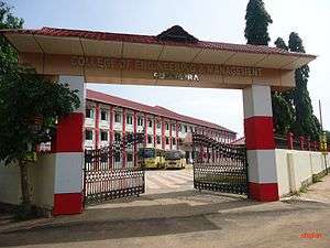
- College of Engineering and Management, Punnapra[68]
- Mar Gregorios College Punnapra[69]
- College of Engineering Chengannur[70]
- College of Applied Sciences, Mavelikkara[71]
- Carmel College of Engineering and Technology Alappuzha[72]
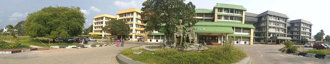
- Government T D Medical College, Alappuzha[73]
- St. Joseph's College for Women, Alappuzha[74]
- St. Michael's college, Cherthala[75]
- T. K. Madhava Memorial College[76]
- St. Aloysius college Edathua[77]
See also
- Alappuzha East
- Alappuzha West
- List of people from Alappuzha
- Travancore Labour Association
- Technical Higher Secondary School, Cherthala, Pallippuram
- Ernakulam-Kayamkulam coastal railway line
- KCA Cricket Stadium, Alappuzha
References
- http://www.censusindia.gov.in/2011-prov-results/paper2/data_files/India2/Table_2_PR_Cities_1Lakh_and_Above.pdf
- http://timesofindia.indiatimes.com/india/Alappuzha-Panaji-and-Mysuru-cleanest-cities-in-India-CSE-survey/articleshow/53160264.cms
- reference encyclopedia of Kerala in Malayalam language
- "all about Alappuzha "Archived copy". Archived from the original on 18 July 2011. Retrieved 2011-06-05.CS1 maint: archived copy as title (link)"
- tourism in India
- "Alappuzha". Archived from the original on 21 May 2012. Retrieved 20 May 2012.
- "Nehru Trophy Boat Race."Archived copy". Archived from the original on 18 July 2011. Retrieved 2011-06-05.CS1 maint: archived copy as title (link)"
- "Struggles".
- "coir industry "Archived copy". Archived from the original on 13 August 2011. Retrieved 2011-06-05.CS1 maint: archived copy as title (link)"
- Central Coir Research Institute Archived 28 December 2012 at the Wayback Machine
- Baiju Natarajan (2008). Cities of Kerala, Actually Small Towns. Radhika Sabavala. p. 70. ISBN 978-81-85026-84-8.
- taluks in Alappuzha 1957
- boundaries
- taluks in Alappuzha
- "History", Allapuzha, the Venice of the East, alappuzha.nic.in Archived 15 January 2014 at the Wayback Machine
- Kuttanad
- Mukkal Vattam in Muhamma
- "Arthunkal Church history". Arthunkal Church.
- A History of Trade & Commerce in Travancore, 1600-1805 by K. K. Kusuman
- Alappuzha - A brief history
- "Maps, Weather, Videos, and Airports for Alappuzha, India". Fallingrain.com. Retrieved 25 September 2013.
- elevation Archived 16 November 2011 at the Wayback Machine
- National waterway 3
- Kuttanad1
- rainfall
- "Station: Alleppy (Alappuzha) Climatological Table 1981–2010" (PDF). Climatological Normals 1981–2010. India Meteorological Department. January 2015. pp. 33–34. Archived from the original (PDF) on 5 February 2020. Retrieved 19 February 2020.
- "Extremes of Temperature & Rainfall for Indian Stations (Up to 2012)" (PDF). India Meteorological Department. December 2016. p. M105. Archived from the original (PDF) on 5 February 2020. Retrieved 19 February 2020.
- "populstat". Archived from the original on 17 February 2013. Retrieved 4 June 2011.
- censusindia
- census of Kerala 2011
- density of Alappuzha Archived 15 August 2010 at the Wayback Machine
- population 2011
- dialect
- "migration of konakanis". Gosripuram.org.in. Archived from the original on 27 September 2013. Retrieved 25 September 2013.
- "migration of konakanis". Gsbkonkani.net. Retrieved 25 September 2013.
- "migration of konakanis
- coir industry
- "mats "Archived copy" (PDF). Archived from the original (PDF) on 9 April 2011. Retrieved 2011-06-06.CS1 maint: archived copy as title (link)"
- coir board
- "coir research "Archived copy". Archived from the original on 12 September 2011. Retrieved 2011-06-05.CS1 maint: archived copy as title (link)"
- coir design
- "coir". Scribd.com. Retrieved 25 September 2013.
- "Keltron Controls "Archived copy". Archived from the original on 27 July 2011. Retrieved 2011-06-07.CS1 maint: archived copy as title (link)"
- "coir mat "Archived copy". Archived from the original on 13 August 2011. Retrieved 2011-06-07.CS1 maint: archived copy as title (link)"
- M.S. Swaminathan, FRS (May 2013). "The Kuttanadu Below Sea Level Farming System, India" (PDF). FAO Website. p. 8. Archived from the original (PDF) on 11 June 2015. Retrieved 8 October 2013.
- G S Unnikrishanan Nair (September 2013). "Kuttanad; Our Heritage Our wealth" (PDF). KERALA CALLING. pp. 16–20. Archived from the original (PDF) on 27 September 2013. Retrieved 26 September 2013.
- "Alappuzha tourist places".
- "Jawahar Thayankari lifts Nehru trophy".
- "PWD Public Site". Archived from the original on 1 December 2010. Retrieved 7 June 2016.
- "Trains from Alappuzha "Archived copy". Archived from the original on 6 September 2011. Retrieved 2011-06-07.CS1 maint: archived copy as title (link)"
- "Trains passing through Alappuzha "Archived copy". Archived from the original on 6 September 2011. Retrieved 2011-06-07.CS1 maint: archived copy as title (link)"
- "SD College- KCA Cricket Ground- Alapuzha".
- "official "Archived copy". Archived from the original on 21 July 2011. Retrieved 2011-06-09.CS1 maint: archived copy as title (link)"
- "sp "Archived copy". Archived from the original on 7 August 2011. Retrieved 2012-04-22.CS1 maint: archived copy as title (link)"
- "Administration "Archived copy". Archived from the original on 21 July 2011. Retrieved 2011-06-09.CS1 maint: archived copy as title (link)"
- Niyamsabha official site
- constituency
- "education in Alappuzha "Archived copy". Archived from the original on 7 August 2011. Retrieved 2011-06-10.CS1 maint: archived copy as title (link)"
- "Leo 13 school "Archived copy". Archived from the original on 26 April 2012. Retrieved 2011-06-10.CS1 maint: archived copy as title (link)"
- "colleges in Alappuzha "Archived copy". Archived from the original on 7 August 2011. Retrieved 2011-06-10.CS1 maint: archived copy as title (link)"
- "CollegeOfEngineering, Cherthala". Cectl.ac.in. Retrieved 25 September 2013.
- "Official website of Cochin University of Science and Technology".
- "Welcome - Sanatana Dharma College".
- "Welcome".
- "SN COLLEGE CHERTHALA".
- "NSS Alappuzha". Grotal.com. Retrieved 25 September 2013.
- "Home Page - Government College, Ambalapuzha".
- unni, visakh. "CEM Punnapra".
- "Mar Gregorios College". Archived from the original on 19 October 2015. Retrieved 7 October 2018.
- "College of Engineering(Chengannur)". Ceconline.edu. Retrieved 25 September 2013.
- Super User. "Profile of the College - College of Applied Sciences, Mavelikkara".
- "Carmel college of Engineering and Technology". Carmel College of Engineering and Technology.
- "Government TD Medical College Alappuzha, Kerala".
- SJCW
- SMC "Archived copy". Archived from the original on 27 May 2010. Retrieved 18 February 2016.CS1 maint: archived copy as title (link)
- "TKM "Archived copy". Archived from the original on 26 September 2011. Retrieved 2016-02-18.CS1 maint: archived copy as title (link)"
- "St Aloysius". Aloysiuscollege.org. Retrieved 25 September 2013.
- fallingrain. "Alappuzha geographic location". Retrieved 4 June 2011.
- msnindia. "Alappuzha annual weather". Archived from the original on 2 September 2011. Retrieved 4 June 2011.
- holidayso. "Alappuzha – Venice of the East". Retrieved 7 July 2017.
External links
| Wikimedia Commons has media related to Alappuzha. |

- Kerala State Water Transport Department official website
- Official website of Alappuzha District
- Alapuzha - Venice of the East
| Districts |
|  |
|---|---|---|
| Towns and cities |
| |
Kerala topics | |||||||||||||
|---|---|---|---|---|---|---|---|---|---|---|---|---|---|
| History |
| ||||||||||||
| Government Politics |
| ||||||||||||
| Incidents | |||||||||||||
| Geography |
| ||||||||||||
| Demographics Economy Religion |
| ||||||||||||
| Culture |
| ||||||||||||
| Tourism |
| ||||||||||||