Kattakada
Kattakada is a Taluk and a suburb in Trivandrum, the capital city of the Indian state of Kerala. It is situated 13km west of Neyyattinkara Town, 18km south of Nedumangad town and 22km south-west of Capital City Trivandrum.
Kattakada | |
|---|---|
Town | |
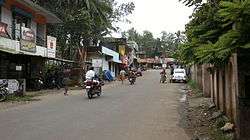 Kattakkada Road at Ottasekharamangalam | |
| Coordinates: 8°30′15″N 77°4′49″E | |
| Country | |
| State | Kerala |
| District | Thiruvananthapuram district |
| Government | |
| • Type | Government |
| • Body | Kattakada Grama Panchayath |
| Area | |
| • Total | 22.54 km2 (8.70 sq mi) |
| Population (2011)[1] | |
| • Total | 40,448 |
| • Density | 1,800/km2 (4,600/sq mi) |
| Languages | |
| • Official | Malayalam, English |
| Time zone | UTC+5:30 (IST) |
| PIN | 695572 |
| Telephone code | 0471 |
| Vehicle registration | KL-74 |
Location
Kattakada is in the eastern part of Thiruvanathapram (Trivandrum) District. It is situated about 18 km east of Trivandrum, the capital of Kerala. To its north is situated Nedumangad (18 km) and to its south, Neyyattinkara (14 km). It is a commercial centre and the second biggest market of hill products in the district , after Nedumangad. Neyyar Dam, a tourist spot and the core of Agasthyavanam Wildlife Sanctuary , is only 10 km away from Kattakada at kuttichal panchyath, towards the east. Thus, Kattakada is situated at the centre of four places: Trivandrum to the west, Neyyattinkara to the south, Neyyar Dam to the east and Nedumangad to the north.
The nearest railway stations are Trivandrum Central(18 km), Balaramapuram (10 km) and Neyyattinkara (13 km).
The nearest airport is Thiruvananthapuram International Airport.
See also
- Mandapathinkadavu
- Neyyattinkara
- Neyyattinkara Railway Station
- Amaravila
- kuttichal
- Kanjiramkulam
- Peyad
- Parassala
- Neyyattinkara Sree Krishna Swami Temple
- Upper cloth revolt
- Thiruvananthapuram
- Municipalities of Kerala
References
- "Panchayat Population". Thiruvananthapuram district. Archived from the original on 29 June 2007. Retrieved 11 March 2008.
External links
- Kattakkada Taluk formed
- ASRTECH Website designing and developing
- -Kripabag-Complete Printing of Bags, Covers, Bigshoppers...etc
- About Kattakada - In the Local Self Government, Kerala website
- About Kattakada - In the Official Website of Church of South India (CSI) Parish Kattakada
- Kattakada Details on 1city.in
- Map of Thiruvananthapuram District
- About Kattakada
- map
District HQ: Thiruvananthapuram | |||||||
| History | 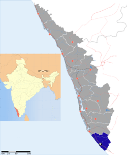 | ||||||
| Geography | |||||||
| Cities and Taluks |
| ||||||
| Transport | |||||||
| Education |
| ||||||
| Buildings | |||||||
| Culture | |||||||
| Lok Sabha constituencies | |||||||
| Sports |
| ||||||
| Museums | |||||||