Turner Glacier
| Turner Glacier | |
|---|---|
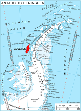 Location of Adelaide Island in the Antarctic Peninsula | |
 Location of Turner Glacier in Antarctica | |
| Location | Adelaide Island |
| Coordinates | 67°37′S 68°29′W / 67.617°S 68.483°W / -67.617; -68.483 |
| Thickness | unknown |
| Terminus | Ryder Bay |
| Status | unknown |
Turner Glacier (67°37′S 68°29′W / 67.617°S 68.483°W / -67.617; -68.483Coordinates: 67°37′S 68°29′W / 67.617°S 68.483°W / -67.617; -68.483) is a glacier on the east side of Mount Liotard flowing northeast into Ryder Bay, Adelaide Island. The glacier was surveyed by Falkland Islands Dependencies Survey (FIDS), 1948, and photographed from the air by Falkland Islands and Dependencies Aerial Survey Expedition (FIDASE), 1956-57. Named by the United Kingdom Antarctic Place-Names Committee (UK-APC) in 1977 after Andrew John Turner, British Antarctic Survey (BAS) builder, Halley Station, 1973–74; Signy Island, 1974–75; Rothera Station, 1976–77, 1978–80; and Faraday Station, 1982-83.
See also

| Types | |||||||
|---|---|---|---|---|---|---|---|
| Anatomy | |||||||
| Processes | |||||||
| Measurements | |||||||
| Volcanic relations | |||||||
| Landforms |
| ||||||
| |||||||
This article is issued from
Wikipedia.
The text is licensed under Creative Commons - Attribution - Sharealike.
Additional terms may apply for the media files.