Commonwealth Glacier
| Commonwealth Glacier | |
|---|---|
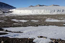 The Commonwealth Glacier in 2009 | |
 Location of Commonwealth Glacier in Antarctica | |
| Location | Victoria Land |
| Coordinates | 77°34′S 163°15′E / 77.567°S 163.250°E / -77.567; 163.250 |
| Thickness | unknown |
| Terminus | Taylor Valley |
| Status | unknown |
Commonwealth Glacier is a glacier which flows in a southeasterly direction and enters the northern side of Taylor Valley immediately west of Mount Coleman, in Victoria Land, Antarctica. It was charted by the British Antarctic Expedition, 1910–13 (BrAE ), under Robert Falcon Scott, and named by them for the Commonwealth of Australia, which made a financial grant to the BrAE and contributed two members to the Western Geological Party which explored this area. The north end of the glacier is bounded by Flint Ridge.
See also
References

Coordinates: 77°34′S 163°15′E / 77.567°S 163.250°E / -77.567; 163.250
This article is issued from
Wikipedia.
The text is licensed under Creative Commons - Attribution - Sharealike.
Additional terms may apply for the media files.