Adelaide Island
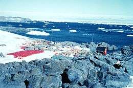 Adelaide Base, February 1962 | |
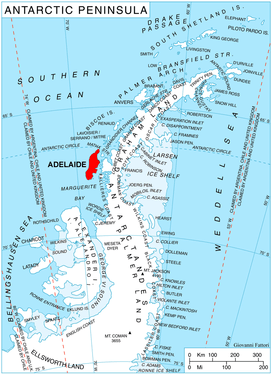 Adelaide Island shown within the Antarctic Peninsula | |
| Geography | |
|---|---|
| Location | Antarctica |
| Coordinates | 67°15′S 68°30′W / 67.25°S 68.5°WCoordinates: 67°15′S 68°30′W / 67.25°S 68.5°W |
| Area | 4,663 km2 (1,800 sq mi) |
| Length | 139 km (86.4 mi) |
| Width | 37 km (23 mi) |
| Highest elevation | 2,315 m (7,595 ft) |
| Highest point | Mount Gaudry |
| Administration | |
| Administered under the Antarctic Treaty System | |
| Demographics | |
| Population | around 100 |
Adelaide Island or Isla Adelaida or Isla Belgrano is a large, mainly ice-covered island, 139 kilometres (75 nmi) long and 37 kilometres (20 nmi) wide, lying at the north side of Marguerite Bay off the west coast of the Antarctic Peninsula. The Ginger Islands lie off the southern end. Mount Bodys is the easternmost mountain on Adelaide Island, rising to over 1,220 m. The island lies within the Argentine, British and Chilean Antarctic claims.
History
Adelaide Island was discovered in 1832 by a British expedition under John Biscoe.[1] The island was first surveyed by the French Antarctic Expedition (1908–1910) under Jean-Baptiste Charcot.
According to a contemporary source, the island was named by Biscoe himself in honour of Queen Adelaide of the United Kingdom.[2]
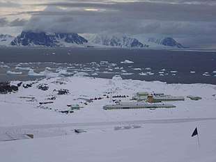
The Island has two bases on it. The old Adelaide Island base (also known as Base T) was set up by the Falkland Islands Dependencies Survey (FIDS), which became the British Antarctic Survey. The Base was closed due to an unstable skiway and operations were moved to the new Rothera Research Station during 1976-77; this base remains open. The old BAS base was transferred to the Chilean authorities in 1984, when it was renamed Teniente Luis Carvajal Villaroel Antarctic Base. The station was then used as a summer only station by the Chileans. However, the skiway and 'ramp' to the station from the plateau have all become so unstable that the Chilean Air Force (FACh) have ceased operating there. The Chilean Navy has visited the station almost every summer to ensure it is in good keeping. BAS employees also visit the station during the winter when access from the plateau is easier.
Due to the length of time that it has been inhabited the island is well mapped by Antarctic standards.
See also
References
- ↑ Stanton, William (1975). The Great United States Exploring Expedition. Berkeley: University of California Press. p. 147. ISBN 0520025571.
- ↑ Extract from the 'Tasmanian' of Hobart (11 October 1833). "Interesting to the World at Large". The Sydney Monitor, 2 November 1833. Retrieved 26 March 2015.
External links
![]()
| Authority control |
|---|