Sheldon Glacier
| Sheldon Glacier | |
|---|---|
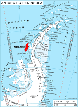 Location of Adelaide Island in the Antarctic Peninsula | |
 Location of Sheldon Glacier in Antarctica | |
| Location | Adelaide Island |
| Coordinates | 67°30′S 68°23′W / 67.500°S 68.383°W / -67.500; -68.383 |
| Thickness | unknown |
| Terminus | Ryder Bay |
| Status | unknown |
Sheldon Glacier (67°30′S 68°23′W / 67.500°S 68.383°W / -67.500; -68.383Coordinates: 67°30′S 68°23′W / 67.500°S 68.383°W / -67.500; -68.383) is a glacier flowing southeast from Mount Mangin into Ryder Bay, Adelaide Island, Antarctica. Named by the United Kingdom Antarctic Place-Names Committee (UK-APC) in 1977 for Ernest B. Sheldon, British Antarctic Survey (BAS) meteorological observer, Adelaide Station, 1968–69, and Stonington Island, 1969–70; Base Commander, Adelaide Station, 1975–76, and Rothera Station, 1976-77.
Prior to 1977, the glacier was called "Crumbles Glacier".[1]
See also
References
- ↑ Bryan, R. 1965. Observations on snow accumulation patterns at Adelaide Island. Brit. Antarc. Surv. Bull., 6, 51–62, page 51. At: http://www.antarctica.ac.uk/documents/bas_bulletins/bulletin06_07.pdf
![]()
| Types | |||||||
|---|---|---|---|---|---|---|---|
| Anatomy | |||||||
| Processes | |||||||
| Measurements | |||||||
| Volcanic relations | |||||||
| Landforms |
| ||||||
| |||||||