Dobbratz Glacier
| Dobbratz Glacier | |
|---|---|
 Location of Heritage Range in Western Antarctica | |
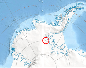
 Location of Dobbratz Glacier in Antarctica | |
| Type | tributary |
| Location | Ellsworth Land |
| Coordinates | 79°24′00″S 85°05′00″W / 79.40000°S 85.08333°W / -79.40000; -85.08333 |
| Thickness | unknown |
| Terminus | Splettstoesser Glacier |
| Status | unknown |
Dobbratz Glacier (79°24′S 85°5′W / 79.400°S 85.083°W / -79.400; -85.083Coordinates: 79°24′S 85°5′W / 79.400°S 85.083°W / -79.400; -85.083) is a broad tributary glacier which drains the south part of the White Escarpment and flows northeast between the Watlack Hills and the Webers Peaks into Splettstoesser Glacier, in the Heritage Range. It was named by the University of Minnesota Geological Party, 1963–64, for Major Joseph Dobbratz, a United States Marine Corps pilot who supported the party.[1]
See also
References
- ↑ "Dobbratz Glacier". Geographic Names Information System. United States Geological Survey. Retrieved 2012-01-22.

| Types | |||||||
|---|---|---|---|---|---|---|---|
| Anatomy | |||||||
| Processes | |||||||
| Measurements | |||||||
| Volcanic relations | |||||||
| Landforms |
| ||||||
| |||||||
This article is issued from
Wikipedia.
The text is licensed under Creative Commons - Attribution - Sharealike.
Additional terms may apply for the media files.