Enravota Glacier
Enravota Glacier (Bulgarian: ледник Енравота, ‘Lednik Enravota’ \'led-nik en-ra-'vo-ta\) is the 10 km long and 3.5 km wide glacier on Nordenskjöld Coast in Graham Land situated southwest of Vrachesh Glacier and north of lower Drygalski Glacier. It drains the south slopes of Ruth Ridge, and flows southeastwards to join Drygalski Glacier east of Bekker Nunataks. The feature is named after the Bulgarian prince St. Boyan-Enravota (9th century).
Location
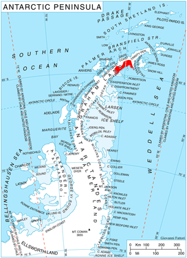
Enravota Glacier is located at 64°41′00″S 60°48′10″W / 64.68333°S 60.80278°W / -64.68333; -60.80278Coordinates: 64°41′00″S 60°48′10″W / 64.68333°S 60.80278°W / -64.68333; -60.80278. British mapping in 1978.
Maps
- British Antarctic Territory. Scale 1:200000 topographic map. DOS 610 Series, Sheet W 64 60. Directorate of Overseas Surveys, Tolworth, UK, 1978.
- Antarctic Digital Database (ADD). Scale 1:250000 topographic map of Antarctica. Scientific Committee on Antarctic Research (SCAR). Since 1993, regularly upgraded and updated.
References
- Enravota Glacier. SCAR Composite Antarctic Gazetteer.
- Bulgarian Antarctic Gazetteer. Antarctic Place-names Commission. (details in Bulgarian, basic data in English)
This article includes information from the Antarctic Place-names Commission of Bulgaria which is used with permission.