Hotine Glacier
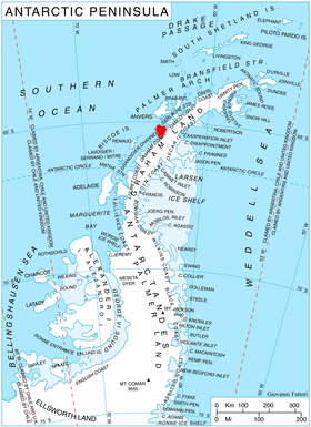
Location of Kiev Peninsula in Graham Land, Antarctic Peninsula.
Hotine Glacier (65°8′S 63°52′W / 65.133°S 63.867°W / -65.133; -63.867Coordinates: 65°8′S 63°52′W / 65.133°S 63.867°W / -65.133; -63.867) is a glacier 10 nautical miles (19 km) long which is divided at its mouth by Mount Cloos, flowing west into both Deloncle Bay and Girard Bay on Kiev Peninsula, on the west coast of Graham Land, Antarctica. It was first charted by the Belgian Antarctic Expedition under Gerlache, 1897–99, and was named by the UK Antarctic Place-Names Committee in 1959 for Brigadier Martin Hotine, Director of Overseas Surveys.[1]
References
- ↑ "Hotine Glacier". Geographic Names Information System. United States Geological Survey. Retrieved 2012-06-28.
![]()
This article is issued from
Wikipedia.
The text is licensed under Creative Commons - Attribution - Sharealike.
Additional terms may apply for the media files.