Zimzelen Glacier
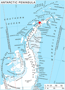
Zimzelen Glacier (Bulgarian: ледник Зимзелен, ‘Lednik Zimzelen’ \'led-nik 'zim-ze-leb\) is the 3.7 km long and 2.5 km wide glacier on Pefaur (Ventimiglia) Peninsula, Danco Coast on the west side of Antarctic Peninsula, situated east of Krapets Glacier and west of Blériot Glacier It drains northwards, and flowing into the east arm of Salvesen Cove.
The glacier is named after the settlement of Zimzelen in Southern Bulgaria.
Location
Zimzelen Glacier is centred at 64°27′00″S 61°17′40″W / 64.45000°S 61.29444°W / -64.45000; -61.29444Coordinates: 64°27′00″S 61°17′40″W / 64.45000°S 61.29444°W / -64.45000; -61.29444. British mapping in 1978.
Maps
- British Antarctic Territory. Scale 1:200000 topographic map. DOS 610 Series, Sheet W 64 60. Directorate of Overseas Surveys, Tolworth, UK, 1978.
- Antarctic Digital Database (ADD). Scale 1:250000 topographic map of Antarctica. Scientific Committee on Antarctic Research (SCAR). Since 1993, regularly upgraded and updated.
References
- Bulgarian Antarctic Gazetteer. Antarctic Place-names Commission. (details in Bulgarian, basic data in English)
- Zimzelen Glacier. SCAR Composite Gazetteer of Antarctica
This article includes information from the Antarctic Place-names Commission of Bulgaria which is used with permission.