Grimes Glacier
| Grimes Glacier | |
|---|---|
 Location of Heritage Range in Western Antarctica | |
 Location of Grimes Glacier in Antarctica | |
| Type | steep |
| Location | Ellsworth Land |
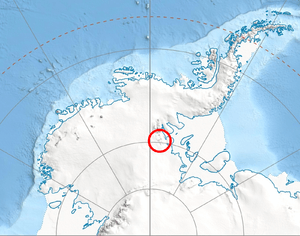
| Coordinates | 79°12′00″S 84°22′00″W / 79.20000°S 84.36667°W / -79.20000; -84.36667 |
| Thickness | unknown |
| Terminus | Heritage Range |
| Status | unknown |
Grimes Glacier (79°12′S 84°22′W / 79.200°S 84.367°W / -79.200; -84.367Coordinates: 79°12′S 84°22′W / 79.200°S 84.367°W / -79.200; -84.367) is a steep glacier descending from the east side of Anderson Massif, in the Heritage Range of the Ellsworth Mountains of Antarctica. It was mapped by the United States Geological Survey from surveys and U.S. Navy air photos, 1961–66, and was named by the Advisory Committee on Antarctic Names for Master Chief Equipmentman Paul D. Grimes, U.S. Navy, who supervised the construction crews during relocation of Williams Air Field at McMurdo Sound in the closing month of U.S. Navy Operation Deep Freeze 1965.[1]
See also
References
- ↑ "Grimes Glacier". Geographic Names Information System. United States Geological Survey. Retrieved 2012-05-08.

| Types | |||||||
|---|---|---|---|---|---|---|---|
| Anatomy | |||||||
| Processes | |||||||
| Measurements | |||||||
| Volcanic relations | |||||||
| Landforms |
| ||||||
| |||||||
This article is issued from
Wikipedia.
The text is licensed under Creative Commons - Attribution - Sharealike.
Additional terms may apply for the media files.