Quito Glacier
| Quito Glacier | |
|---|---|
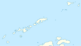
 Location of Greenwich Island in the South Shetland Islands | |
 Quito Glacier (Antarctica) Show map of Antarctica | |
| Location |
Greenwich Island South Shetland Islands |
| Coordinates | 62°27′00″S 59°47′00″W / 62.45000°S 59.78333°W / -62.45000; -59.78333 |
| Thickness | unknown |
| Terminus | Canto Point |
| Status | unknown |

Topographic map of Livingston Island, Greenwich, Robert, Snow and Smith Islands.
Quito Glacier (62°27′S 59°47′W / 62.450°S 59.783°W / -62.450; -59.783Coordinates: 62°27′S 59°47′W / 62.450°S 59.783°W / -62.450; -59.783) is a glacier draining the northeast slopes of Mount Plymouth and flowing northeastwards into the sea west of Canto Point in north Greenwich Island, South Shetland Islands. It was named after the capital of Ecuador, c. 1990, by the Ecuadorian Antarctic Expedition.
See also
Maps
- L.L. Ivanov et al. Antarctica: Livingston Island and Greenwich Island, South Shetland Islands. Scale 1:100000 topographic map. Sofia: Antarctic Place-names Commission of Bulgaria, 2005.
- L.L. Ivanov. Antarctica: Livingston Island and Greenwich, Robert, Snow and Smith Islands. Scale 1:120000 topographic map. Troyan: Manfred Wörner Foundation, 2009. ISBN 978-954-92032-6-4
References

External Links
| Types | |||||||
|---|---|---|---|---|---|---|---|
| Anatomy | |||||||
| Processes | |||||||
| Measurements | |||||||
| Volcanic relations | |||||||
| Landforms |
| ||||||
| |||||||
This article is issued from
Wikipedia.
The text is licensed under Creative Commons - Attribution - Sharealike.
Additional terms may apply for the media files.