Sarasota County, Florida
| Sarasota County, Florida | |||
|---|---|---|---|
| County | |||
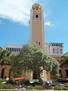 Sarasota County Courthouse in June 2011 | |||
| |||
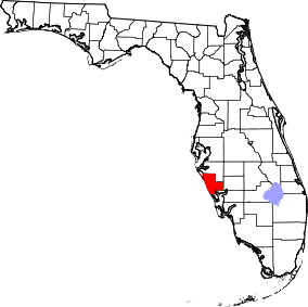 Location in the U.S. state of Florida | |||
 Florida's location in the U.S. | |||
| Founded | May 14, 1921 | ||
| Seat | Sarasota | ||
| Largest city | North Port | ||
| Area | |||
| • Total | 725 sq mi (1,878 km2) | ||
| • Land | 556 sq mi (1,440 km2) | ||
| • Water | 169 sq mi (438 km2), 23.4% | ||
| Population (est.) | |||
| • (2017) | 419,119 | ||
| • Density | 754/sq mi (291/km2) | ||
| ZIP Code(s) | 34223, 34229–34278, 34284–34289, 34292, 34293, 34295 | ||
| Area code(s) | 941 | ||
| Congressional districts | 16th, 17th | ||
| Time zone | Eastern: UTC−5/−4 | ||
| Website |
www | ||
Sarasota County is located in Southwest Florida on the Gulf Coast. As of the 2010 US Census, the population was 379,448.[1] Its county seat is Sarasota (with an estimated 2016 population of 56,610)[2] and its largest city is North Port with an estimated 2016 population of 64,274. Sarasota County compromises the North Port-Sarasota-Bradenton, FL Metropolitan Statistical Area.
History

Sarasota County was created in 1921. After acquisition by the United States as a territory and once Florida obtained state status, the area now included in the county had been governed by Hillsborough County, then Manatee County as the state was divided into smaller and smaller governmental organizations. Manatee County was carved up to allow the creation of three more counties as well.
Although the name was associated with the area from the beginning of European contacts the origin of the name, Sarasota, is unknown. Some believe a fanciful story created for a popular early twentieth-century pageant held in Sarasota, that it was named after the daughter of famous explorer Hernando de Soto's daughter Sara.
According to the Florida League of Cities, the name first appeared in print as "Zarazote" on a 1763 land grant map.
Joseph Daniel Anderson was one of the pioneers of the Sarasota area. He established his homestead in the Forked Creek area in 1886 and became an early leader in what now is southern Sarasota County (having been Manatee County from 1855 until 1921).
The following is a transcript from a Sarasota County historical marker that was erected in a park dedicated to Anderson on Manasota Key.
- "After the Civil War, many Georgians moved their families to Southern Florida. Joseph Daniel "Jody" Anderson, born in Georgia in 1867, was a child when his father moved to the Tampa/Sara Sota area. In 1884, Joseph became the head of the Anderson family. Two years later, he moved his family to Southern Manatee County. He homesteaded the land in the Mystic River (Forked Creek) Valley. In 1890 he married Helen Alice Johnson of Sarasota. They had eleven children. Eight survived.
- With only hand tools, Anderson converted the Florida wilderness into an agricultural industry. This fertile land produced vegetables, sugar cane and citrus. In the vast Myakka/Pinedale area, he raised his cattle and swine. He and brother Moses "Lee" prospered in ranching until the Range Law Act curtailed the right to use this land for grazing.
- Sleds (later wagons) were used to move the farm produce, fruit and cattle to Lemon Bay where they were transferred to draft boats and transported to ships at Boca Grande. Some of the wagons were rafted across the bay to Manasota Beach where the produce was ferried to Cuban smacks and later to American schooners.
- Anderson pioneered commercial fishing in North Lemon Bay which teemed with schools of mullet and other fish. The Andersons fished with nets made of cotton and flax twine over which they poured a heavy lime solution to prevent rot. Their base of operation included land storage facilities on the shore and on the beach (Manasota) to salt, dry and pack the fish in barrels. Upon the arrival of run boats with ice from Tampa, the Andersons could ship fresh fish and produce.
- Joseph Daniel "Jody" Anderson was a quiet family man who never sought publicity. However, before Sarasota County was organized, he served as deputy sheriff and game warden in the Pinedale/Manasota area. The Anderson family built the area's first school (Pinedale) of which Jody was trustee. He also organized the first church in the area. Anderson actively supported the creation of Sarasota County from Manatee County and in 1922, became the first elected county commissioner from District 4. After the death of his first wife, he married Mary Ethel Morgan with whom he raised four more children. Joseph Daniel Anderson died in 1939."
Geography
According to the U.S. Census Bureau, the county has a total area of 725 square miles (1,880 km2), of which 556 square miles (1,440 km2) is land and 169 square miles (440 km2) (23.4%) is water.[3]
Adjacent counties
- Manatee County - north
- DeSoto County - east
- Charlotte County - south
Parks and preserves
In addition to local parks there are several preserve areas including:
- Bayonne Parcel
- Circus Hammock
- Curry Creek Preserve
- Deer Prairie Creek
- Jelks Preserve
- Lemon Bay Preserve
- Manasota Scrub Preserve
- Myakka Islands Point
- Old Miakka Preserve
- Pinelands Reserve
- Pocono Trail Preserve
- Red Bug Slough
- Sleeping Turtles South
- Sleeping Turtles North
- South Lemon Bay Preserve
- T. Mabry Carlton Reserve
Government and politics
Sarasota County is one of only 20 Florida counties with its own charter, adopted in 1971. Sarasota County is governed by a five-member county commission. Each commissioner serves a four-year term and resides in and represent a single district, but is elected countywide.
The county's politics are dominated by the Republican Party; Franklin D. Roosevelt was the last Democratic presidential candidate to win the county (in 1944)[4] and Republicans have historically dominated the county commission and other countywide elected positions.
| Year | Republican | Democratic | Others |
|---|---|---|---|
| 2016 | 53.79% 124,438 | 42.30% 97,870 | 3.91% 9,045 |
| 2012 | 53.14% 110,504 | 45.74% 95,119 | 1.12% 2,338 |
| 2008 | 49.47% 102,897 | 49.37% 102,686 | 1.16% 2,422 |
| 2004 | 53.51% 104,692 | 45.20% 88,442 | 1.29% 2,518 |
| 2000 | 51.63% 83,117 | 45.27% 72,869 | 3.10% 4,991 |
| 1996 | 46.46% 69,213 | 42.73% 63,665 | 10.81% 16,108 |
| 1992 | 42.76% 66,855 | 34.89% 54,552 | 22.35% 34,945 |
| 1988 | 66.40% 84,602 | 33.04% 42,099 | 0.56% 708 |
| 1984 | 74.15% 87,771 | 25.79% 30,525 | 0.06% 69 |
| 1980 | 68.57% 68,065 | 25.81% 25,621 | 5.62% 5,579 |
| 1976 | 61.78% 44,157 | 36.78% 26,293 | 1.44% 1,028 |
| 1972 | 79.95% 48,939 | 19.99% 12,235 | 0.06% 36 |
| 1968 | 63.73% 30,160 | 21.40% 10,127 | 14.88% 7,041 |
| 1964 | 61.13% 21,917 | 38.87% 13,937 | |
| 1960 | 70.70% 19,995 | 29.30% 8,287 | |
| 1956 | 73.40% 13,937 | 26.60% 5,052 | |
| 1952 | 70.74% 9,538 | 29.26% 3,945 | |
| 1948 | 49.95% 3,559 | 32.31% 2,302 | 17.74% 1,264 |
| 1944 | 37.99% 2,109 | 62.01% 3,443 | |
| 1940 | 30.71% 1,672 | 69.29% 3,773 | |
| 1936 | 30.38% 1,055 | 69.62% 2,418 | |
| 1932 | 25.86% 667 | 74.14% 1,912 | |
| 1928 | 56.46% 1,603 | 41.60% 1,181 | 1.94% 55 |
| 1924 | 40.48% 187 | 44.16% 204 | 15.36% 71 |
Public safety
Fire/EMS
The Sarasota County Fire Department (SCFD) provides fire services to the City of Sarasota and all unincorporated areas of the county with the exception of areas covered by the Nokomis and Englewood fire districts. Additionally, SCFD provides EMS service to the City of Sarasota, all unincorporated areas of the county (including areas covered by the Nokomis and Englewood fire districts) plus the city of Venice.[6]
Law enforcement
The Sarasota County Sheriff's Office (SSO) is the county's primary law enforcement agency. It is responsible for patrolling the unincorporated areas of the county along with operating the county's jail and providing courtroom security. SSO also operates the county's primary 911 center. The cities of Sarasota, North Port and Venice along with the Town of Longboat Key each have their own police departments. The Florida Highway Patrol is responsible for patrolling FDOT maintained roads in the county (Florida State Highway System) and investigating motor vehicle accidents that occur in unincorporated areas.[7]
Three specialist law enforcement agencies have jurisdiction in the county: the Sarasota-Bradenton International Airport Police Department,[8] the New College/USF Sarasota-Manatee Campus Police Department[9] and the Seminole Gulf Railway (SGLR) Police Department.[10] Each agency has jurisdiction in neighboring Manatee County as well; each agency's properties extend into that county.
Party for Socialism and Liberation - Florida
The Party for Socialism and Liberation has its state headquarters in Sarasota, Florida.[11]
Voter Registration
All voter information is as of September 18, 2018 and provided by Sarasota County Supervisor of Elections Office:[12]
Party Statistics
| Party | Registered Voters | Percentage | |
|---|---|---|---|
| Republican | 134,349 | 42.54% | |
| Democratic | 97,062 | 30.73% | |
| No party affiliation | 82,141 | 26.01% | |
| Independent Party of Florida | 1,124 | 0.36% | |
| Libertarian Party | 828 | 0.26% | |
| Green Party | 229 | 0.07% | |
| Constitution Party | 32 | 0.01% | |
| Reform Party | 32 | 0.01% | |
| Party for Socialism and Liberation | 18 | 0.00% | |
| Ecology Party of Florida | 7 | 0.00% | |
| Total Voters | 315,822 | 100.00% |
| Gender | Population |
|---|---|
| Female | 165,532(52.41%) |
| Male | 140,935(44.62%) |
| Unknown | 9,357(2.96%) |
| Race | Population |
|---|---|
| White Non-Hispanic | 276,986(87.70%) |
| Hispanic | 12,115(3.84%) |
| Black | 10,183(3.22%) |
| Unknown | 9,208(2.92%) |
| Asian/Pac. Islander | 3,448(1.09%) |
| Other | 1,782(0.56%) |
| Multi-Racial | 1,151(0.36%) |
| Indian/Alaskan Native | 951(0.30%) |
| Age range | Population |
|---|---|
| 18–20 | 6,971(2.21%) |
| 21–29 | 27,622(8.75%) |
| 30–55 | 92,688(29.35%) |
| 56–64 | 53,649(16.99%) |
| 65+ | 134,894(42.71%) |
Transportation
Airports
- Sarasota-Bradenton International Airport, in both Manatee County (runway) and Sarasota County (terminal).
- Venice Municipal Airport, a general aviation airport in Venice.
- Hidden River Airport, a private airport in the eastern part of the county.
- Buchan Airport, in Englewood.
Major highways and state roads


Public transportation
- Sarasota County Area Transit (SCAT) provides public transportation for Sarasota County, Florida. SCAT is operated by Sarasota County. It maintains 19 fixed-line bus routes plus a dial-a-ride paratransit service (SCAT Plus).[13]
Demographics
| Historical population | |||
|---|---|---|---|
| Census | Pop. | %± | |
| 1930 | 12,440 | — | |
| 1940 | 16,106 | 29.5% | |
| 1950 | 28,827 | 79.0% | |
| 1960 | 76,895 | 166.7% | |
| 1970 | 120,413 | 56.6% | |
| 1980 | 202,251 | 68.0% | |
| 1990 | 277,776 | 37.3% | |
| 2000 | 325,957 | 17.3% | |
| 2010 | 379,448 | 16.4% | |
| Est. 2017 | 419,119 | [14] | 10.5% |
| U.S. Decennial Census[15] 1790-1960[16] 1900-1990[17] 1990-2000[18] 2010-2015[1] | |||

As of the census[19] of 2000, there were 325,957 people, 149,937 households, and 94,460 families residing in the county. The population density was 570 people per square mile (220/km2). There were 182,467 housing units at an average density of 319 per square mile (123/km2). The racial makeup of the county was 92.65% White, 4.18% Black or African American, 0.22% Native American, 0.77% Asian, 0.03% Pacific Islander, 1.14% from other races, and 1.02% from two or more races. 4.34% of the population were Hispanic or Latino of any race. 89.7% spoke only English at home; 4.4% spoke Spanish, 1.3% German, and 1.0% French at home.
Census Estimates for 2005 show the county population as being 87.5% non-Hispanic whites, 6.3% Latinos, 4.5% African-American and 1.1% Asian.[20]
In 2000, there were 149,957 households out of which 18.30% had children under the age of 18 living with them, 52.70% were married couples living together, 7.70% had a female householder with no husband present, and 37.00% were non-families. 30.40% of all households were made up of individuals and 16.90% had someone living alone who was 65 years of age or older. The average household size was 2.13 and the average family size was 2.61.
In the county, the age distribution was as follows: 16.20% under the age of 18, 5.00% from 18 to 24, 21.70% from 25 to 44, 25.60% from 45 to 64, and 31.50% who were 65 years of age or older. The median age was 50 years. For every 100 females there were 90.00 males. For every 100 females age 18 and over, there were 87.30 males.
The median income for a household in the county was $41,957, and the median income for a family was $50,111. About 5.10% of families and 7.80% of the population were below the poverty line, including 12.70% of those under age 18 and 4.50% of those age 65 or over.
The per capita income for the county was $28,326. Females had a median income of $25,721 versus $32,114 for males.
- Population in Sarasota County counted in 2016 had reached 412,569 people.[21]
Economy
Top private employers
As of January 2018, the top private employers for Sarasota County are as follows:[22]
- Sarasota Memorial Health Care System (4,563)
- PGT Innovations (2,000)
- Publix (1,733)
- Venice Regional Medical Center (812)
- Sun Hydraulics (632)
- Tervis Tumbler (570)
- Shared Services Center Sarasota (455)
- FCCI Insurance (426)
- Doctors Hospital (415)
- Jackson Hewitt, Inc. (337)
Sports and recreation
Sarasota County is home to Ed Smith Stadium, where the Baltimore Orioles currently have spring training. The Orioles also have minor league facilities at Twin Lakes Park. In January 2017, the Braves announced a formal agreement to move their Spring Training home to North Port, FL.[23]
Education
Primary and secondary education
- Sarasota County Public Schools - Public K-12 School district serving all of Sarasota County
Higher education
- Keiser University Sarasota - Branch campus of Keiser University.
- New College of Florida - Public liberal arts college. Honors college of the state of Florida.
- Ringling College of Art and Design - A private, 4 year, not-for-profit, fully accredited college with concentrations in art and design.
- State College of Florida, Manatee–Sarasota - South Venice Campus of SCF.
- University of South Florida Sarasota-Manatee - Branch campus of USF.
Museums and libraries
| Established | 1907 |
|---|---|
| Branches | 10 |
| Collection | |
| Size | 900,975 |
| Other information | |
| Budget | $14.1 million (FY 2019) |
| Staff | 154.5 FTE |
| Website | scgov.net/library |
| References: FY 2019 Adopted Budget[24] | |
Sarasota County Public Library Branches:[25]
- Elsie Quirk Public Library
- Frances T. Bourne Jacaranda Public Library
- Fruitville Public Library
- Gulf Gate Public Library
- North Port Public Library
- North Sarasota Public Library
- The Osprey Public Library at the Historic Spanish Point
- Selby Public Library
- Shannon Staub Library
- Venice Public Library
Sarasota County residents may obtain library cards for free and valid library cards may be used to check out materials at all nine Sarasota County libraries. Manatee and Charlotte County residents, as well as library users from any of the Tampa Bay Library Consortium libraries may register as reciprocal borrowers and check out materials in Sarasota County. Non-resident cards are available for purchase and offer the same privileges as resident cards.
The library system provides a variety of services which include adult, teen and children's materials. Computers for public use are available at all nine Sarasota County Libraries and free wireless access in the libraries is provided by the Sarasota County Government. The library system has licensing to the Cloud Library, OverDrive, Inc. and Freegal Music. Ask a Librarian, the on-line Florida librarian reference system is available through the Sarasota County Public Library System. Sarasota County residents have access to the Pinellas Talking Book Library as well as a Books-by-Mail service.[26] The Selby Public Library has been a selective depository in the Federal Depository Library Program and receives almost 50% of the government publications distributed through the program.[26] Additionally, the Sarasota County Library System is an organization member of the Florida Library Association.
The Little Free Library program was introduced to Sarasota County in 2014 as the result of a collaborative effort between the Libraries and Historical Resources department, the Parks, Recreation and Natural Resources department and the UF/IFAS Sarasota County Extension and Sustainability department. The Sarasota County Little Free Libraries have been placed at thirteen different county parks and recreation centers.[27]
Library History
The first library, which was established in 1907 by the Sarasota Town Improvement Society. County libraries have been established in response to community demands and needs.
The first libraries were autonomous with the Head Librarians reporting directly to the County Administrator. Sarasota Public Library was managed by Betty Service, the Englewood library by Harriet Ives, and Venice by Jean McGuire. Joan Hopkins directed and coordinated library services for the rapidly growing population. She directed the establishment of Gulf Gate Public Library, North Port Public Library, Frances T. Bourne Jacaranda Public Library and the new downtown Sarasota library, and laid the groundwork for building future libraries in the county.[28]
Local media
Newspapers
- North Port Sun - an edition of the Charlotte Sun newspapers.
- Sarasota Herald Tribune - primarily serves Sarasota County for news, but also serves Manatee, Charlotte and DeSoto counties. Circulation is 110,817 daily and 132,185 on Sunday (2005 averages).[29] Also operates an online news portal, HeraldTribune.com.
- Scene Magazine, a civic, business and social publication serving Sarasota and Manatee counties.[30]
- Observer Media Group newspapers: East County Observer, Longboat Observer, Sarasota Observer, Siesta Key Observer.[31]
- The Sarasota News Leader - online weekly news.
- Venice Gondolier Sun.
Television
Sarasota County is part of the Tampa/St. Petersburg/Sarasota DMA. Most of the television stations are located in Saint Petersburg or Tampa except:
Radio
- WSLR-LP - (96.5 community radio).
- WSRQ - (98.9 FM 106.9 FM 1220 AM Talk Radio).
Communities
Cities
Town
Census-designated places
See also
References
- 1 2 "State & County QuickFacts". United States Census Bureau. Retrieved June 16, 2014.
- ↑ "Find a County". National Association of Counties. Retrieved September 13, 2018.
- ↑ "US Gazetteer files: 2010, 2000, and 1990". United States Census Bureau. February 12, 2011. Archived from the original on March 12, 2012. Retrieved April 23, 2011.
- ↑ "Sarasota and Manatee wallets open for president's campaign". Sarasota Herald-Tribune. Archived from the original on December 22, 2014. Retrieved November 27, 2014.
- ↑ "Archived copy". Archived from the original on April 14, 2012. Retrieved April 14, 2012.
- ↑ "Fire Department". Sarasota County government. Archived from the original on December 4, 2014. Retrieved November 27, 2014.
- ↑ "Jurisdiction of the Florida Highway Patrol" (PDF). flhsmv.gov. Archived (PDF) from the original on December 28, 2016. Retrieved March 18, 2018.
- ↑ "Airport Police". Sarasota-Bradenton International Airport. Archived from the original on December 5, 2014. Retrieved November 27, 2014.
- ↑ "Campus Police". New College of Florida. Archived from the original on November 23, 2014. Retrieved November 27, 2014.
- ↑ "41426 - Decision". Surface Transportation Board. Archived from the original on December 4, 2014. Retrieved November 27, 2014.
- ↑ "Committee Tracking system - Florida Division of Elections - Department of State". dos.elections.myflorida.com. Archived from the original on July 26, 2016. Retrieved March 21, 2017.
- ↑ "Sarasota County, FL : Supervisor of Elections". SOE Software Corporation. September 18, 2018. Retrieved September 18, 2018.
- ↑ "Archived copy". Archived from the original on December 3, 2013. Retrieved November 26, 2013.
- ↑ "Population and Housing Unit Estimates". Archived from the original on May 29, 2017. Retrieved June 9, 2017.
- ↑ "U.S. Decennial Census". United States Census Bureau. Archived from the original on May 12, 2015. Retrieved June 16, 2014.
- ↑ "Historical Census Browser". University of Virginia Library. Archived from the original on August 16, 2012. Retrieved June 16, 2014.
- ↑ "Population of Counties by Decennial Census: 1900 to 1990". United States Census Bureau. Archived from the original on February 20, 2014. Retrieved June 16, 2014.
- ↑ "Census 2000 PHC-T-4. Ranking Tables for Counties: 1990 and 2000" (PDF). United States Census Bureau. Archived (PDF) from the original on December 18, 2014. Retrieved June 16, 2014.
- ↑ "American FactFinder". United States Census Bureau. Archived from the original on September 11, 2013. Retrieved May 14, 2011.
- ↑ "Census Bureau Home Page". census.gov. Archived from the original on July 18, 2011. Retrieved March 18, 2018.
- ↑ Bureau, U.S. Census. "American FactFinder - Community Facts". factfinder.census.gov. Archived from the original on June 8, 2011. Retrieved March 18, 2018.
- ↑ "Top Employers". EDC Sarasota. January 2018. Archived from the original on April 10, 2018. Retrieved April 9, 2018.
- ↑ Murdock, Zack (January 17, 2017). "Atlanta Braves pick Sarasota County for spring training". Sarasota Herald-Tribune. Archived from the original on February 28, 2017. Retrieved February 27, 2017.
- ↑ "FY19 Adopted Budget Overview". Sarasota County Government. September 27, 2018. Retrieved October 11, 2018.
- ↑ "Locations and Hours". Sarasota County Government. Archived from the original on April 10, 2018. Retrieved April 9, 2018.
- 1 2 "Services and Policies". Sarasota County Government. Archived from the original on April 10, 2018. Retrieved April 9, 2018.
- ↑ "Little Free Libraries". Sarasota County Government. Archived from the original on April 10, 2018. Retrieved April 9, 2018.
- ↑ Florida Library History Project, "Sarasota County Library System" (1990). Digital Collection - Florida Studies Center Publications. Paper 96
- ↑ "HeraldTribune.com - About Us: Fact Sheet - About Us: Fact Sheet - HeraldTribune.com". heraldtribune.com. Archived from the original on March 4, 2016. Retrieved March 18, 2018.
- ↑ "About Scene". Scene Magazine. Archived from the original on April 18, 2016. Retrieved April 17, 2016.
- ↑ Observer Media Group. "About Us". Archived from the original on December 22, 2017. Retrieved December 18, 2017.
Places adjacent to Sarasota County, Florida | ||||||||||
|---|---|---|---|---|---|---|---|---|---|---|
| ||||||||||
Municipalities and communities of Sarasota County, Florida, United States | ||
|---|---|---|
| Cities | | |
| Town | ||
| CDPs | ||
| Unincorporated communities | ||
| Footnotes | ‡This populated place also has portions in an adjacent county or counties | |
