Saint-Mathieu-de-Tréviers
| Saint-Mathieu-de-Tréviers | ||
|---|---|---|
| Commune | ||
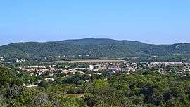 A general view of Saint-Mathieu-de-Tréviers | ||
| ||
 Saint-Mathieu-de-Tréviers Location within Occitanie region  Saint-Mathieu-de-Tréviers | ||
| Coordinates: 43°46′14″N 3°52′10″E / 43.7706°N 3.8694°ECoordinates: 43°46′14″N 3°52′10″E / 43.7706°N 3.8694°E | ||
| Country | France | |
| Region | Occitanie | |
| Department | Hérault | |
| Arrondissement | Lodève | |
| Canton | Saint-Gély-du-Fesc | |
| Intercommunality | Pic-Saint-Loup | |
| Government | ||
| • Mayor (2008–2014) | Jerôme Lopez | |
| Area1 | 21.92 km2 (8.46 sq mi) | |
| Population (2008)2 | 4,660 | |
| • Density | 210/km2 (550/sq mi) | |
| Time zone | UTC+1 (CET) | |
| • Summer (DST) | UTC+2 (CEST) | |
| INSEE/Postal code | 34276 /34270 | |
| Elevation |
78–400 m (256–1,312 ft) (avg. 81 m or 266 ft) | |
|
1 French Land Register data, which excludes lakes, ponds, glaciers > 1 km2 (0.386 sq mi or 247 acres) and river estuaries. 2 Population without double counting: residents of multiple communes (e.g., students and military personnel) only counted once. | ||
.svg.png)
Saint-Mathieu-de-Tréviers is a commune in the Hérault department in the Occitanie region in southern France.
Population
| Historical population | ||
|---|---|---|
| Year | Pop. | ±% |
| 1962 | 534 | — |
| 1968 | 571 | +6.9% |
| 1975 | 954 | +67.1% |
| 1982 | 1,505 | +57.8% |
| 1990 | 2,623 | +74.3% |
| 1999 | 3,713 | +41.6% |
| 2008 | 4,660 | +25.5% |
See also
References
| Wikimedia Commons has media related to Saint-Mathieu-de-Tréviers. |
This article is issued from
Wikipedia.
The text is licensed under Creative Commons - Attribution - Sharealike.
Additional terms may apply for the media files.