Valergues
| Valergues | ||
|---|---|---|
| Commune | ||
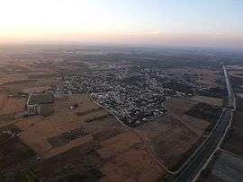 An aerial view of Valergues | ||
| ||
 Valergues Location within Occitanie region  Valergues | ||
| Coordinates: 43°40′07″N 4°03′45″E / 43.6686°N 4.0625°ECoordinates: 43°40′07″N 4°03′45″E / 43.6686°N 4.0625°E | ||
| Country | France | |
| Region | Occitanie | |
| Department | Hérault | |
| Arrondissement | Montpellier | |
| Canton | Mauguio | |
| Intercommunality | Pays de Lunel | |
| Government | ||
| • Mayor (2008–2014) | Jean-Louis Bouscarain | |
| Area1 | 5.2 km2 (2.0 sq mi) | |
| Population (2008)2 | 1,996 | |
| • Density | 380/km2 (990/sq mi) | |
| Time zone | UTC+1 (CET) | |
| • Summer (DST) | UTC+2 (CEST) | |
| INSEE/Postal code | 34321 /34130 | |
| Elevation |
9–41 m (30–135 ft) (avg. 18 m or 59 ft) | |
|
1 French Land Register data, which excludes lakes, ponds, glaciers > 1 km2 (0.386 sq mi or 247 acres) and river estuaries. 2 Population without double counting: residents of multiple communes (e.g., students and military personnel) only counted once. | ||
.svg.png)
Valergues is a commune in the Hérault department in the Occitanie region in southern France.
Population
| Historical population | ||
|---|---|---|
| Year | Pop. | ±% |
| 1962 | 336 | — |
| 1968 | 390 | +16.1% |
| 1975 | 411 | +5.4% |
| 1982 | 575 | +39.9% |
| 1990 | 936 | +62.8% |
| 1999 | 1,740 | +85.9% |
| 2008 | 1,996 | +14.7% |
See also
References
| Wikimedia Commons has media related to Valergues. |
This article is issued from
Wikipedia.
The text is licensed under Creative Commons - Attribution - Sharealike.
Additional terms may apply for the media files.