Montbazin
| Montbazin | ||
|---|---|---|
| Commune | ||
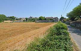 A general view of Montbazin | ||
| ||
 Montbazin Location within Occitanie region  Montbazin | ||
| Coordinates: 43°31′00″N 3°41′48″E / 43.5167°N 3.6967°ECoordinates: 43°31′00″N 3°41′48″E / 43.5167°N 3.6967°E | ||
| Country | France | |
| Region | Occitanie | |
| Department | Hérault | |
| Arrondissement | Montpellier | |
| Canton | Mèze | |
| Intercommunality | CA Bassin de Thau | |
| Government | ||
| • Mayor (2008–2014) | Laure Tondon | |
| Area1 | 21.13 km2 (8.16 sq mi) | |
| Population (2008)2 | 2,468 | |
| • Density | 120/km2 (300/sq mi) | |
| Time zone | UTC+1 (CET) | |
| • Summer (DST) | UTC+2 (CEST) | |
| INSEE/Postal code | 34165 /34560 | |
| Elevation |
16–313 m (52–1,027 ft) (avg. 34 m or 112 ft) | |
|
1 French Land Register data, which excludes lakes, ponds, glaciers > 1 km2 (0.386 sq mi or 247 acres) and river estuaries. 2 Population without double counting: residents of multiple communes (e.g., students and military personnel) only counted once. | ||
.svg.png)
Montbazin is a commune in the Hérault department in the Occitanie region in southern France.

Map
Administration
| Mayor of Montbazin | Elected | Party |
|---|---|---|
| Laure Tondon | March 2001 | PS |
| Lucien Labit | March 1996 |
Gallery
 Église Saint-Pierre de Montbazin
 A street in the village
 Trail in the garrigue on the Moure Hills
 Colonies of sand hill snails
Population
Its inhabitants are referred to as Montbazinois.
| Historical population | ||
|---|---|---|
| Year | Pop. | ±% |
| 1962 | 1,012 | — |
| 1968 | 1,041 | +2.9% |
| 1975 | 1,109 | +6.5% |
| 1982 | 1,377 | +24.2% |
| 1990 | 2,062 | +49.7% |
| 1999 | 2,214 | +7.4% |
| 2008 | 2,468 | +11.5% |
See also
References
External links
| Wikimedia Commons has media related to Montbazin. |
- (in French) Mayor's Website
- (in French) Montbazin Webzine
- (in French) Montbazin on the Quid site
- (in French) Montbazin on the map of France
- (in French) Photos of the garrigues de thau tour of Montbazin
This article is issued from
Wikipedia.
The text is licensed under Creative Commons - Attribution - Sharealike.
Additional terms may apply for the media files.