Argelliers
| Argelliers | ||
|---|---|---|
| Commune | ||
| ||
 Argelliers Location within Occitanie region  Argelliers | ||
| Coordinates: 43°41′55″N 3°40′29″E / 43.6986°N 3.6747°ECoordinates: 43°41′55″N 3°40′29″E / 43.6986°N 3.6747°E | ||
| Country | France | |
| Region | Occitanie | |
| Department | Hérault | |
| Arrondissement | Lodève | |
| Canton | Gignac | |
| Intercommunality | CC Vallée Hérault | |
| Government | ||
| • Mayor (2014-2020) | Georges Pierrugues | |
| Area1 | 50.29 km2 (19.42 sq mi) | |
| Population (2015)2 | 1,018 | |
| • Density | 20/km2 (52/sq mi) | |
| Time zone | UTC+1 (CET) | |
| • Summer (DST) | UTC+2 (CEST) | |
| INSEE/Postal code | 34012 /34380 | |
| Elevation |
80–531 m (262–1,742 ft) (avg. 230 m or 750 ft) | |
|
1 French Land Register data, which excludes lakes, ponds, glaciers > 1 km2 (0.386 sq mi or 247 acres) and river estuaries. 2 Population without double counting: residents of multiple communes (e.g., students and military personnel) only counted once. | ||
.svg.png)
Argelliers (Occitan: Argelièrs) is a commune in the Hérault department in southern France.
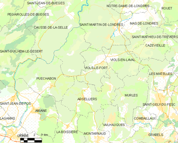
Map
See also
References
External links
| Wikimedia Commons has media related to Argelliers. |
This article is issued from
Wikipedia.
The text is licensed under Creative Commons - Attribution - Sharealike.
Additional terms may apply for the media files.