Viols-en-Laval
| Viols-en-Laval | ||
|---|---|---|
| Commune | ||
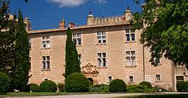 Chateau of Cambous | ||
| ||
 Viols-en-Laval Location within Occitanie region  Viols-en-Laval | ||
| Coordinates: 43°45′15″N 3°43′32″E / 43.7542°N 3.7256°ECoordinates: 43°45′15″N 3°43′32″E / 43.7542°N 3.7256°E | ||
| Country | France | |
| Region | Occitanie | |
| Department | Hérault | |
| Arrondissement | Lodève | |
| Canton | Lodève | |
| Intercommunality | Séranne-Pic Saint-Loup | |
| Government | ||
| • Mayor (2008–2014) | Élisabeth Capillon | |
| Area1 | 16.03 km2 (6.19 sq mi) | |
| Population (2008)2 | 202 | |
| • Density | 13/km2 (33/sq mi) | |
| Time zone | UTC+1 (CET) | |
| • Summer (DST) | UTC+2 (CEST) | |
| INSEE/Postal code | 34342 /34380 | |
| Elevation |
186–320 m (610–1,050 ft) (avg. 256 m or 840 ft) | |
|
1 French Land Register data, which excludes lakes, ponds, glaciers > 1 km2 (0.386 sq mi or 247 acres) and river estuaries. 2 Population without double counting: residents of multiple communes (e.g., students and military personnel) only counted once. | ||
.svg.png)
Viols-en-Laval is a commune in the Hérault department in the Occitanie region in southern France.
Population
| Historical population | ||
|---|---|---|
| Year | Pop. | ±% |
| 1962 | 15 | — |
| 1968 | 23 | +53.3% |
| 1975 | 26 | +13.0% |
| 1982 | 32 | +23.1% |
| 1990 | 82 | +156.2% |
| 1999 | 177 | +115.9% |
| 2008 | 202 | +14.1% |
See also
References
| Wikimedia Commons has media related to Viols-en-Laval. |
This article is issued from
Wikipedia.
The text is licensed under Creative Commons - Attribution - Sharealike.
Additional terms may apply for the media files.