Galargues
| Galargues | ||
|---|---|---|
| Commune | ||
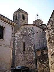 The church of Notre-Dame-de-l'Assomption | ||
| ||
 Galargues Location within Occitanie region  Galargues | ||
| Coordinates: 43°46′17″N 4°01′19″E / 43.7714°N 4.0219°ECoordinates: 43°46′17″N 4°01′19″E / 43.7714°N 4.0219°E | ||
| Country | France | |
| Region | Occitanie | |
| Department | Hérault | |
| Arrondissement | Montpellier | |
| Canton | Lunel | |
| Intercommunality | Ceps et Sylves | |
| Government | ||
| • Mayor (2008–2014) | Jean-Marie Hurtemel | |
| Area1 | 11.43 km2 (4.41 sq mi) | |
| Population (2008)2 | 629 | |
| • Density | 55/km2 (140/sq mi) | |
| Time zone | UTC+1 (CET) | |
| • Summer (DST) | UTC+2 (CEST) | |
| INSEE/Postal code | 34110 /34160 | |
| Elevation |
29–257 m (95–843 ft) (avg. 54 m or 177 ft) | |
|
1 French Land Register data, which excludes lakes, ponds, glaciers > 1 km2 (0.386 sq mi or 247 acres) and river estuaries. 2 Population without double counting: residents of multiple communes (e.g., students and military personnel) only counted once. | ||

Galargues is a commune in the Hérault département in Occitanie in southern France.
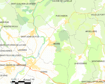
Map
Population
| Historical population | ||
|---|---|---|
| Year | Pop. | ±% |
| 1962 | 265 | — |
| 1968 | 279 | +5.3% |
| 1975 | 253 | −9.3% |
| 1982 | 342 | +35.2% |
| 1990 | 404 | +18.1% |
| 1999 | 519 | +28.5% |
| 2008 | 629 | +21.2% |
See also
References
| Wikimedia Commons has media related to Galargues. |
This article is issued from
Wikipedia.
The text is licensed under Creative Commons - Attribution - Sharealike.
Additional terms may apply for the media files.