Causses-et-Veyran
| Causses-et-Veyran | ||
|---|---|---|
| Commune | ||
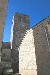 The bell tower of Causses-et-Veyran | ||
| ||
 Causses-et-Veyran Location within Occitanie region  Causses-et-Veyran | ||
| Coordinates: 43°28′31″N 3°05′13″E / 43.4753°N 3.0869°ECoordinates: 43°28′31″N 3°05′13″E / 43.4753°N 3.0869°E | ||
| Country | France | |
| Region | Occitanie | |
| Department | Hérault | |
| Arrondissement | Béziers | |
| Canton | Cazouls-lès-Béziers | |
| Intercommunality | CC Les Avant-Monts | |
| Government | ||
| • Mayor (2008–2014) | Gérard Baro | |
| Area1 | 17.65 km2 (6.81 sq mi) | |
| Population (2008)2 | 600 | |
| • Density | 34/km2 (88/sq mi) | |
| Time zone | UTC+1 (CET) | |
| • Summer (DST) | UTC+2 (CEST) | |
| INSEE/Postal code | 34061 /34490 | |
| Elevation |
33–403 m (108–1,322 ft) (avg. 150 m or 490 ft) | |
|
1 French Land Register data, which excludes lakes, ponds, glaciers > 1 km2 (0.386 sq mi or 247 acres) and river estuaries. 2 Population without double counting: residents of multiple communes (e.g., students and military personnel) only counted once. | ||
.svg.png)
Causses-et-Veyran is a commune in the Hérault department in southern France.
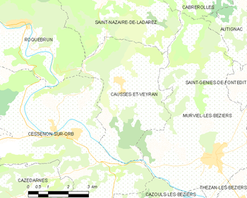
Map
Population
| Historical population | ||
|---|---|---|
| Year | Pop. | ±% |
| 1800 | 313 | — |
| 1851 | 565 | +80.5% |
| 1901 | 848 | +50.1% |
| 1921 | 922 | +8.7% |
| 1946 | 767 | −16.8% |
| 1936 | 1,011 | +31.8% |
| 1962 | 546 | −46.0% |
| 1968 | 612 | +12.1% |
| 1975 | 503 | −17.8% |
| 1982 | 503 | +0.0% |
| 1990 | 504 | +0.2% |
| 1999 | 546 | +8.3% |
| 2008 | 600 | +9.9% |
See also
References
| Wikimedia Commons has media related to Causses-et-Veyran. |
| Authority control |
|---|
This article is issued from
Wikipedia.
The text is licensed under Creative Commons - Attribution - Sharealike.
Additional terms may apply for the media files.