Pouzols
| Pouzols | ||
|---|---|---|
| Commune | ||
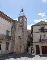 The bell tower in Pouzols | ||
| ||
 Pouzols Location within Occitanie region  Pouzols | ||
| Coordinates: 43°37′09″N 3°30′48″E / 43.6192°N 3.5133°ECoordinates: 43°37′09″N 3°30′48″E / 43.6192°N 3.5133°E | ||
| Country | France | |
| Region | Occitanie | |
| Department | Hérault | |
| Arrondissement | Lodève | |
| Canton | Gignac | |
| Intercommunality | Vallée de l'Hérault | |
| Government | ||
| • Mayor (2008–2014) | Jacques Donnadieu | |
| Area1 | 2.96 km2 (1.14 sq mi) | |
| Population (2008)2 | 824 | |
| • Density | 280/km2 (720/sq mi) | |
| Time zone | UTC+1 (CET) | |
| • Summer (DST) | UTC+2 (CEST) | |
| INSEE/Postal code | 34215 /34230 | |
| Elevation |
27–100 m (89–328 ft) (avg. 48 m or 157 ft) | |
|
1 French Land Register data, which excludes lakes, ponds, glaciers > 1 km2 (0.386 sq mi or 247 acres) and river estuaries. 2 Population without double counting: residents of multiple communes (e.g., students and military personnel) only counted once. | ||
.svg.png)
Pouzols is a commune in the Hérault department in the Occitanie region in southern France.
Population
| Historical population | ||
|---|---|---|
| Year | Pop. | ±% |
| 1962 | 385 | — |
| 1968 | 413 | +7.3% |
| 1975 | 335 | −18.9% |
| 1982 | 368 | +9.9% |
| 1990 | 436 | +18.5% |
| 1999 | 629 | +44.3% |
| 2008 | 824 | +31.0% |
See also
References
| Wikimedia Commons has media related to Pouzols. |
This article is issued from
Wikipedia.
The text is licensed under Creative Commons - Attribution - Sharealike.
Additional terms may apply for the media files.