Joncels
| Joncels | ||
|---|---|---|
| Commune | ||
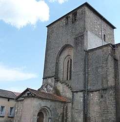 Church | ||
| ||
 Joncels Location within Occitanie region  Joncels | ||
| Coordinates: 43°44′18″N 3°11′43″E / 43.7383°N 3.1953°ECoordinates: 43°44′18″N 3°11′43″E / 43.7383°N 3.1953°E | ||
| Country | France | |
| Region | Occitanie | |
| Department | Hérault | |
| Arrondissement | Béziers | |
| Canton | Clermont-l'Hérault | |
| Intercommunality | Avène, Orb et Gravezon | |
| Government | ||
| • Mayor (2008–2014) | Rémy Paillès | |
| Area1 | 46.24 km2 (17.85 sq mi) | |
| Population (2008)2 | 276 | |
| • Density | 6.0/km2 (15/sq mi) | |
| Time zone | UTC+1 (CET) | |
| • Summer (DST) | UTC+2 (CEST) | |
| INSEE/Postal code | 34121 /34650 | |
| Elevation |
290–835 m (951–2,740 ft) (avg. 380 m or 1,250 ft) | |
|
1 French Land Register data, which excludes lakes, ponds, glaciers > 1 km2 (0.386 sq mi or 247 acres) and river estuaries. 2 Population without double counting: residents of multiple communes (e.g., students and military personnel) only counted once. | ||
.svg.png)
Joncels is a commune in the Hérault département in the Occitanie region in southern France.
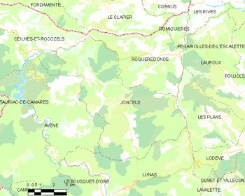
Map
Population
| Historical population | ||
|---|---|---|
| Year | Pop. | ±% |
| 1962 | 247 | — |
| 1968 | 222 | −10.1% |
| 1975 | 198 | −10.8% |
| 1982 | 203 | +2.5% |
| 1990 | 222 | +9.4% |
| 1999 | 227 | +2.3% |
| 2006 | 257 | +13.2% |
| Source: Ldh/EHESS/Cassini[1] | ||
See also
References
| Wikimedia Commons has media related to Joncels. |
| Authority control |
|---|
This article is issued from
Wikipedia.
The text is licensed under Creative Commons - Attribution - Sharealike.
Additional terms may apply for the media files.