Caux, Hérault
| Caux | ||
|---|---|---|
| Commune | ||
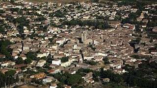 View of Caux | ||
| ||
 Caux Location within Occitanie region  Caux | ||
| Coordinates: 43°30′29″N 3°22′11″E / 43.5081°N 3.3697°ECoordinates: 43°30′29″N 3°22′11″E / 43.5081°N 3.3697°E | ||
| Country | France | |
| Region | Occitanie | |
| Department | Hérault | |
| Arrondissement | Béziers | |
| Canton | Pézenas | |
| Intercommunality | CA Hérault Méditerranée | |
| Government | ||
| • Mayor (2014-2020) | Jean Martinez | |
| Area1 | 24.84 km2 (9.59 sq mi) | |
| Population (2015)2 | 2,547 | |
| • Density | 100/km2 (270/sq mi) | |
| Time zone | UTC+1 (CET) | |
| • Summer (DST) | UTC+2 (CEST) | |
| INSEE/Postal code | 34063 /34720 | |
| Elevation | 27–166 m (89–545 ft) | |
|
1 French Land Register data, which excludes lakes, ponds, glaciers > 1 km2 (0.386 sq mi or 247 acres) and river estuaries. 2 Population without double counting: residents of multiple communes (e.g., students and military personnel) only counted once. | ||
.svg.png)
Caux is a commune in the Hérault department in southern France.
Geography
_hospice.JPG)
View in the circulade
Toponymy
The origin of the name "Caux" has two possible explanations:
- It can come from Occitan "caus" which means "lime". This is possible because limestone is very present on the territory, lime kilns are numerous; we find their remains at Sallèles and Maro Road.
- The name can come from an expression of pre-Indo-European origin: "cal-so", that is to say rock, shelter. Indeed, on its base at 103 meters above sea level, Caux dominates the surroundings.
Population
| Historical population | ||
|---|---|---|
| Year | Pop. | ±% |
| 1962 | 1,648 | — |
| 1968 | 1,711 | +3.8% |
| 1975 | 1,546 | −9.6% |
| 1982 | 1,578 | +2.1% |
| 1990 | 1,709 | +8.3% |
| 1999 | 1,968 | +15.2% |
| 2006 | 2,463 | +25.2% |
| 2011 | 2,490 | +1.1% |
| 2015 | 2,547 | +2.3% |
Administration

Town hall of Caux
| Election | Mayor | Party | Occupation | |
|---|---|---|---|---|
| 1971 | Michel Estadieu | PS | ||
| 1983 | Jacques Vailhère | RPR | ||
| 2001 | Jean Martinez | DVD | Professor at University of Montpellier | |
Personalities
External links
See also
References
| Wikimedia Commons has media related to Caux (Hérault). |
This article is issued from
Wikipedia.
The text is licensed under Creative Commons - Attribution - Sharealike.
Additional terms may apply for the media files.