Lunel-Viel
| Lunel-Viel | ||
|---|---|---|
| Commune | ||
 An aerial view of Lunel-Viel | ||
| ||
 Lunel-Viel Location within Occitanie region  Lunel-Viel | ||
| Coordinates: 43°40′44″N 4°05′33″E / 43.6789°N 4.0925°ECoordinates: 43°40′44″N 4°05′33″E / 43.6789°N 4.0925°E | ||
| Country | France | |
| Region | Occitanie | |
| Department | Hérault | |
| Arrondissement | Montpellier | |
| Canton | Lunel | |
| Intercommunality | Pays de Lunel | |
| Government | ||
| • Mayor (2008–2014) | Jean Charpentier | |
| Area1 | 11.97 km2 (4.62 sq mi) | |
| Population (2008)2 | 3,581 | |
| • Density | 300/km2 (770/sq mi) | |
| Time zone | UTC+1 (CET) | |
| • Summer (DST) | UTC+2 (CEST) | |
| INSEE/Postal code | 34146 /34400 | |
| Elevation |
6–50 m (20–164 ft) (avg. 17 m or 56 ft) | |
|
1 French Land Register data, which excludes lakes, ponds, glaciers > 1 km2 (0.386 sq mi or 247 acres) and river estuaries. 2 Population without double counting: residents of multiple communes (e.g., students and military personnel) only counted once. | ||
.svg.png)
Lunel-Viel is a commune in the Hérault department in southern France.
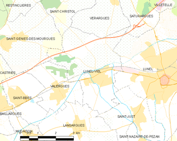
Map
Population
| Historical population | ||
|---|---|---|
| Year | Pop. | ±% |
| 1962 | 1,210 | — |
| 1968 | 1,418 | +17.2% |
| 1975 | 1,331 | −6.1% |
| 1982 | 1,673 | +25.7% |
| 1990 | 2,301 | +37.5% |
| 1999 | 3,174 | +37.9% |
| 2008 | 3,581 | +12.8% |
See also
References
| Wikimedia Commons has media related to Lunel-Viel. |
This article is issued from
Wikipedia.
The text is licensed under Creative Commons - Attribution - Sharealike.
Additional terms may apply for the media files.