Ukrah
| Ukrah Nagarukrah | |
|---|---|
| Village/Neighbourhood near Greater Kolkata | |
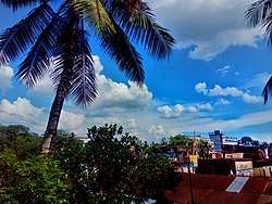 Skyline view of Nagarukhra Old Market Area | |
 Ukrah Location in West Bengal, India  Ukrah Ukrah (India) | |
| Coordinates: 22°56′38″N 88°39′36″E / 22.944°N 88.660°ECoordinates: 22°56′38″N 88°39′36″E / 22.944°N 88.660°E | |
| Country |
|
| State | West Bengal |
| District | Nadia |
| Government | |
| • Type | Village (as per census report) |
| • MLA | Nilima Nag (Mallick) |
| Elevation | 12 m (39 ft) |
| Population (2011) | |
| • Total | 13,548 |
| Languages | |
| • Official | Bengali, English, Hindi |
| Time zone | UTC+5:30 (IST) |
| PIN | 741257 |
| Telephone code | +91 or 03473 |
| ISO 3166 code | IN-WB |
| Sex ratio | 927 ♂/♀ |
| Lok Sabha constituency | Bangaon |
| Vidhan Sabha constituency | Haringhata |
| Website |
nadia |
| Census Village | |
Ukrah or Nagarukhra[1] is a village with its own Police Station and neighborhood of Kolkata Suburban Metropolitan Development Authority (KMDA) in Kalyani subdivision of Nadia district in the Indian state of West Bengal. It is located around 50 kilometres (31 mi) from Kolkata — the capital of West Bengal, forming the northern most boundary of Kolkata metropolitan area.
Geography
Ukrah is located at 22°56′38″N 88°39′36″E / 22.944°N 88.660°E. [2].It has an average elevation of 12 metres (39 ft).[3].
It is bounded by the Jamuna River on the North.
_from_Nagarukhra_Bridge.jpg)
This area is approximately 65 km far from district headquarter, Krishnagar and approximately 50 km. far from the state capital, Kolkata.
Demographics
As of 2011 India census, Ukrah had a population of 13,548, comprising 6,974 males and 6,574 females. Ukrah has an average literacy rate of 83.91%, with 1,309 (9.66%) of the town's population between 0–6 years of age.[4]
Administration
Police Station
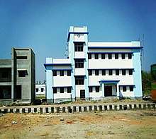
Nagarukhra Police Station[5] is a newly established Juridical administrative Police Department in Nagarukhra. This Police Station has jurisdiction over Nagarukhra and its neighbouring areas (except Haringhata Municipal areas).The New Police Station located on the bank of Jamuna River.
Groundwater contamination
Ukrah is one of the areas where the groundwater is affected by arsenic contamination.[6]
Education
High Schools
Ukrah has three Higher Secondary Schools.
.jpg)
- Nagarukhra High School is the oldest Higher Secondary school of this area.
.jpg)
- Nagarukhra Kshetra-Mohan Girls' High School is the Girls' Higher secondary school as well.
- Dighalgram High School is also a higher secondary school at Dighalgram, Nagarukhra-II.
These schools are undertaken by West Bengal Council of Higher Secondary Education[7].
Without it, many kindergarten schools are available in this region.
English Medium School
Ukrah is going to get an Elementary English medium School, named Michael Madhusudan English Medium Primary & Elementary School.
Dr. Partha Chatterjee announced an English medium school at Christian Colony, Nagarukhra.[8]
Transport
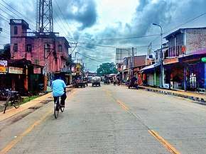
Kanchrapara-Nagarukhra-Bongaon Intercity Military Road [9] passing through Ukrah or Nagarukhra.This road is connected with National Highway 112 to the east, with National Highway 12 and Kalyani Expressway to the west directly.This road is also a shortest roadway to access the Petrapole-Bangladesh Border for Border Security Force and Indian Army. This road also connects many different villages and towns.This road is intersect with other three major roads in Nagarukhra, Ashoknagar-Kalyangarh Road intersection at near Town Kali Bari; Nimtala Road intersection at new market chowmatha crossing and Habra Road intersection at near Anandamoyee Kali Mandir Tinmatha More.
Bus Services
Ukrah or Nagarukhra has various bus services to connect with different places.
Private Bus Lines
- 22. Nagarukhra - Kanchrapara via Duttapara, Fatehpur, Haringhata, Barajaguli, BCKV, Mohanpur, Kampa Army Camp, KPA Station.
- 22. Nagarukhra - Kalyani via Fatehpur, Haringhata, Barajaguli, BSF Camp,7 No., AIIMS-Kalyani, Anandapur.
- 19B. Gaighata - Ranaghat via Jaleswar, Hanspur, Nagarukhra, Haringhata, Birohi, Chakdaha, Simurali, Ranaghat.
- 95. Bongaon - Ashoknagar via Gopalnagar, Palla, Nahata, Chowberia, Nimtala, Kasthadanga, Nagarukhra, Jhikra, Habra.
MN Series
Bus Transit without Number
- Nagarukhra - Kolkata.
- Thakurnagar - Nabadwip Ghat.
- Thakurnagar - Kalna Ghat.
WBTC Route Line
References
- ↑ "Nagarukhra Details - indikosh.com".
- ↑ "Ukhra Weather Forecast". Accuweather.
- ↑ Falling Rain Genomics, Inc - Nagarukhra
- ↑ "Ukhra Population - Nadia, West Bengal". Census-2011. Retrieved 5 April 2016.
- ↑ "Nadia District is getting 23th Police Station in Nagarukhra, West Bengal". The Tribune Journal.
- ↑ "Groundwater arsenic contamination in West Bengal-India (20 years study)". SOES. Retrieved 2011-03-25.
- ↑ "WBCHSE Schools in Nadia Dist".
- ↑ "Nagarukhra is going to get an Elementary English medium school soon". The Tribune Journal.
- ↑ "Kanchrapara - Nagarukhra - Bongaon Highway - OpenstreetMap". OpenstreetMap.org.
External Links
| Wikimedia Commons has media related to Category:Nagarukhra. |
![]()
Cities, towns and locations in Nadia District | |||||||||
|---|---|---|---|---|---|---|---|---|---|
| Cities, municipal and census towns |
| ||||||||
| Locations other than cities and towns |
| ||||||||
| Related topics |
| ||||||||