Dhubulia
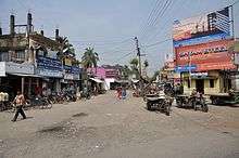
Dhubulia is a village in Krishnanagar II CD Block in Krishnanagar Sadar subdivision of Nadia district of West Bengal, India. It has the biggest tuberculosis hospital in Asia. Belpukur is the oldest neighborhood in the village. National Highway 12 (India) passes through the village.
History
Many people emigrated to Dhubulia from Bangladesh at the time of the partition of India in 1947. Initially, there were several camps set up by the government which were referred to by numbers. Today there are many places where the old numbering system is still used.
During World War II, an army group No. 99 Squadron RAF was based in Dhubulia.
Geography
Dhubulia is located at 23°29′17″N 88°27′05″E / 23.4881900°N 88.4513170°E. Most of the land is either undeveloped or used for cultivation. Typical crops are rice, wheat, mustard, jute and vegetables.
Police station
Dhubulia police station has jurisdiction over Krishnanagar II CD Block.[1][2] The total area covered by the police station is 134.74 km2 and the population covered is 139,020 (2001 census). 5 km of the India-Bangladesh border is within the PS area.[3]
CD Block HQ
The headquarters of Krishnanagar II CD Block are located at Dhubulia.[4]
Demographics
As per the 2011 Census of India, Dhubulia had a total population of 11,623, of which 6,056 (52%) were males and 5,567 (48%) were females. Population below 6 years was 1,005. The total number of literates in Dhubulia was 8,921 (84.02% of the population over 6 years).[5]
Economy
Many of the people depend on cultivation and handloom tant; beautifully designed "tant saree" are produced here.
Education
- Shayama Prasad Shikshayatan High School
- Nivedidita Balika Vidyalaya
- Dhubulia Deshbandhu High School
- Dhubulia Subhas Chandra Valika Vidyalaya
- Nawpara rupdha high school
Cities, towns and locations in Nadia District | |||||||||
|---|---|---|---|---|---|---|---|---|---|
| Cities, municipal and census towns |
| ||||||||
| Locations other than cities and towns |
| ||||||||
| Related topics |
| ||||||||
References
- ↑ "District Statistical Handbook 2014 Nadia". Table 2.1. Department of Statistics and Programme Implementation, Government of West Bengal. Archived from the original on 29 July 2017. Retrieved 17 May 2017.
- ↑ "Nadia District Police". Police Unit. West Bengal Police. Retrieved 17 May 2017.
- ↑ "Dhubulia Police Station Details". Nadia Police. Retrieved 17 May 2017.
- ↑ "District Census Handbook: Nadia, Series 20 Part XII A" (PDF). Map of Nadia with CD Block HQs and Police Stations (on the fourth page). Directorate of Census Operations, West Bengal, 2011. Retrieved 2 May 2017.
- ↑ "2011 Census – Primary Census Abstract Data Tables". West Bengal – District-wise. Registrar General and Census Commissioner, India. Retrieved 18 May 2017.