Taraknagar
| Taraknagar | |
|---|---|
| Village | |
| Coordinates: 23°22′47″N 88°40′47″E / 23.37972°N 88.67972°ECoordinates: 23°22′47″N 88°40′47″E / 23.37972°N 88.67972°E | |
| Country |
|
| State | West Bengal |
| District | Nadia |
| Area | |
| • Total | 3.39 km2 (1.31 sq mi) |
| Elevation | 6 m (20 ft) |
| Languages | |
| • Official | Bengali, English |
| Time zone | UTC+5:30 (IST) |
| PIN | 741502 |
| Telephone code | 03473 |
| Vehicle registration | WB-52 |
| Coastline | 0 kilometres (0 mi) |
| Nearest Town | Bagula |
| Sex ratio | 1.07 ♂/♀ |
| Lok Sabha constituency | Ranaghat |
Taraknagar is a village of Nadia district, West Bengal, India situated 99 km north of Kolkata. Taraknagar is well connected with the state capital Kolkata via Kolkata Suburban Railway. Several local trains come from Sealdah everyday.
Location
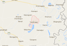
Taraknagar is 99 km north of Kolkata (Calcutta) at 23°23′N 88°41′E / 23.38°N 88.68°E. The village is located around less than 10 km from Bangladesh–India border.
Education
Literacy rate among the elderly people is quite low here. Although every young people are going school. Taraknagar has two high schools (Taraknagar Ma Maharani High School and Taraknagar Jamuna Sundari High School) three primary schools and one kindergarten. Both the high schools are currently providing Arts subjects after class 10th.
Politics
Taraknagar is under 88 - Krishnaganj (Vidhan Sabha constituency) and Ranaghat (Lok Sabha constituency).Taraknagar don't have a panchayat of its own. The village falls under Shibnivas gram panchayat. In 2018 panchayat poll all 4 seats of gram panchayat and only panchayat samity seat of Taraknagar were won by BJP(Edited by Debotpal Mondal).
Administration
Krishnanagar is the district headquarter for Shibnivas Gram Panchayat. The Village is Under Krishnanagar Sadar subdivision of Nadia District.
References
Cities, towns and locations in Nadia District | |||||||||
|---|---|---|---|---|---|---|---|---|---|
| Cities, municipal and census towns |
| ||||||||
| Locations other than cities and towns |
| ||||||||
| Related topics |
| ||||||||