McDowell County, West Virginia
| McDowell County, West Virginia | |
|---|---|
 McDowell County Courthouse in Welch | |
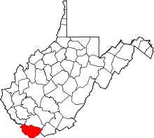 Location in the U.S. state of West Virginia | |
 West Virginia's location in the U.S. | |
| Founded | February 28, 1858 |
| Named for | James McDowell[1] |
| Seat | Welch |
| Largest city | Welch |
| Area | |
| • Total | 535 sq mi (1,386 km2) |
| • Land | 533 sq mi (1,380 km2) |
| • Water | 1.4 sq mi (4 km2), 0.3% |
| Population (est.) | |
| • (2017) | 18,456 |
| • Density | 38/sq mi (15/km2) |
| Congressional district | 3rd |
| Time zone | Eastern: UTC−5/−4 |
| Website |
www |
McDowell County is a county in the U.S. state of West Virginia. As of the 2010 census, the population was 22,113.[2] Its county seat is Welch.[3] McDowell county is the southernmost county in the state. It was created in 1858 by the Virginia General Assembly and named for Virginia Governor James McDowell.[4] It became a part of West Virginia in 1863, when several counties seceded from the state of Virginia during the American Civil War.
McDowell County was also home of the famous Rocket Boys, who were from Coalwood.
History
McDowell County was formed by an act of the Virginia Legislature on February 20, 1858, from what was originally included in Tazewell County, Virginia.[5]
Five years later, the Legislature decided to allow county residents to determine where the county seat should be. They chose Perryville (now called English), which was then the most populated town.[4] "The "Restored Government" commissioners, in October, 1866, located the county seat on a farm near the mouth of Mill Creek, where it remained until it moved to Perryville in 1874."[5] The debate over the location of the county seat continued until 1892. The town of Welch became the county seat.[5]
The county is popularly referred to as the "Free State of McDowell," a name originally coined by a local newspaper editor to refer to the unusual politics and demographics of the area.[6]
McDowell County was nationally known for its prominence in the coal mining industry, setting production records and was a major player in the state's economy. Before the industry's decline beginning in the 1950s, McDowell's population reached nearly 100,000 residents, third highest in the state at that time. It then reduced at a rapid pace in the following decades, setting the highest percentage in the state for population loss with each new census. Younger residents moved out of the county to seek better futures, leaving behind an older and increasingly impoverished population.
Increasing rates of poverty in McDowell County led U.S. President John F. Kennedy to remark in a speech in May 1963:
I don't think any American can be satisfied to find in McDowell County, in West Virginia, 20 or 25 percent of the people of that county out of work, not for 6 weeks or 12 weeks, but for a year, 2, 3, or 4 years.[7]
Geography
McDowell County, the southernmost county in West Virginia, is located at 37°22′N 81°39′W / 37.37°N 81.65°WCoordinates: 37°22′N 81°39′W / 37.37°N 81.65°W. It is bordered by Tazewell County, Virginia, to the south; Buchanan County, Virginia, to the west; Mingo County to the northwest; Wyoming County to the north; and Mercer County to the east. The Appalachian Mountains determine most of the borders of the county.
According to the U.S. Census Bureau, the county has a total area of 535 square miles (1,390 km2), of which 533 square miles (1,380 km2) is land and 1.4 square miles (3.6 km2) (0.3%) is water.[8] The county is roughly in the shape of a semi circle, with the border following the mountains around the county.
Demographics
| Historical population | |||
|---|---|---|---|
| Census | Pop. | %± | |
| 1860 | 1,535 | — | |
| 1870 | 1,952 | 27.2% | |
| 1880 | 3,074 | 57.5% | |
| 1890 | 7,300 | 137.5% | |
| 1900 | 18,747 | 156.8% | |
| 1910 | 47,856 | 155.3% | |
| 1920 | 68,571 | 43.3% | |
| 1930 | 90,479 | 31.9% | |
| 1940 | 94,354 | 4.3% | |
| 1950 | 98,887 | 4.8% | |
| 1960 | 71,359 | −27.8% | |
| 1970 | 50,666 | −29.0% | |
| 1980 | 49,899 | −1.5% | |
| 1990 | 35,233 | −29.4% | |
| 2000 | 27,329 | −22.4% | |
| 2010 | 22,113 | −19.1% | |
| Est. 2017 | 18,456 | [9] | −16.5% |
| U.S. Decennial Census[10] 1790–1960[11] 1900–1990[12] 1990–2000[13] 2010–2015[2] | |||
2010 census
As of the 2010 United States Census, there were 22,113 people, 9,176 households, and 6,196 families residing in the county.[14] The population density was 41.5 inhabitants per square mile (16.0/km2). There were 11,322 housing units at an average density of 21.2 per square mile (8.2/km2).[15] The racial makeup of the county was 89.1% white, 9.5% black or African American, 0.2% American Indian, 0.1% Asian, 0.0% from other races, and 1.1% from two or more races. Those of Hispanic or Latino origin made up 0.4% of the population.[14] The largest ancestry groups were:13.7% Irish, 12.0% German, 11.5% English, 8.0% American, 2.8% Sub-Saharan African, 2.7% Italian, 2.0% Dutch, 1.1% Scotch-Irish [16]
Of the 9,176 households, 28.7% had children under the age of 18 living with them, 48.1% were married couples living together, 13.9% had a female householder with no husband present, 32.5% were non-families, and 28.8% of all households were made up of individuals. The average household size was 2.36 and the average family size was 2.86. The median age was 43.8 years.[14]
The median income for a household in the county was $22,154 and the median income for a family was $28,413. Males had a median income of $31,229 versus $26,776 for females. The per capita income for the county was $12,955. About 27.5% of families and 32.6% of the population were below the poverty line, including 44.3% of those under age 18 and 20.1% of those age 65 or over.[17]
Life expectancy
Of 3,142 counties in the United States in 2013, McDowell County ranked 3,142 in the life expectancy of both male and female residents. Males in McDowell County lived an average of 63.5 years and females lived an average of 71.5 years compared to the national average for life expectancy of 76.5 for males and 81.2 for females. Moreover, the average life expectancy in McDowell County declined by 3.2 years for males and 4.1 years for females between 1985 and 2013 compared to a national average for the same period of an increased life span of 5.5 years for men and 3.1 years for women. High rates of smoking and obesity and a low level of physical activity appear to be contributing factors to the declining life expectancy for both sexes.[18]
Drug-induced deaths
In 2015, McDowell County had the highest rate of drug-induced deaths of any county in the United States, with 141 deaths per 100,000 people. (The rate for the United States as a whole was 14.7 per 100,000 people.[19]) Neighboring Wyoming County had the second highest rate.[20]
Politics
The power of industrial and mining political systems turned it strongly towards the Republican Party between 1890 and 1932 – being strongly Republican enough to even support William Howard Taft during the divided 1912 presidential election.[21]
| Year | Republican | Democratic | Third parties |
|---|---|---|---|
| 2016 | 74.1% 4,629 | 23.0% 1,438 | 2.9% 179 |
| 2012 | 64.0% 3,959 | 34.1% 2,109 | 1.9% 120 |
| 2008 | 44.8% 2,882 | 53.3% 3,430 | 1.8% 118 |
| 2004 | 37.8% 2,762 | 61.7% 4,501 | 0.5% 36 |
| 2000 | 32.2% 2,348 | 66.3% 4,845 | 1.5% 110 |
| 1996 | 18.9% 1,550 | 73.0% 5,989 | 8.2% 669 |
| 1992 | 19.8% 1,941 | 71.8% 7,019 | 8.4% 821 |
| 1988 | 25.4% 2,463 | 74.2% 7,204 | 0.5% 47 |
| 1984 | 33.3% 4,284 | 66.3% 8,546 | 0.4% 53 |
| 1980 | 27.7% 3,862 | 70.4% 9,822 | 1.9% 259 |
| 1976 | 28.0% 4,107 | 72.0% 10,557 | |
| 1972 | 56.8% 8,942 | 43.2% 6,811 | |
| 1968 | 21.2% 4,020 | 67.8% 12,842 | 11.0% 2,075 |
| 1964 | 17.0% 3,684 | 83.1% 18,046 | |
| 1960 | 25.2% 6,555 | 74.8% 19,501 | |
| 1956 | 39.8% 11,138 | 60.2% 16,865 | |
| 1952 | 30.2% 10,663 | 69.8% 24,657 | |
| 1948 | 30.8% 9,687 | 68.5% 21,545 | 0.8% 240 |
| 1944 | 36.4% 11,023 | 63.7% 19,300 | |
| 1940 | 36.3% 13,906 | 63.7% 24,449 | |
| 1936 | 28.1% 9,975 | 71.8% 25,471 | 0.1% 35 |
| 1932 | 56.4% 16,069 | 43.4% 12,365 | 0.3% 80 |
| 1928 | 64.0% 14,810 | 35.9% 8,294 | 0.1% 31 |
| 1924 | 63.0% 12,422 | 28.2% 5,561 | 8.9% 1,749 |
| 1920 | 70.6% 12,198 | 29.3% 5,068 | 0.1% 16 |
| 1916 | 65.6% 7,086 | 34.2% 3,692 | 0.2% 20 |
| 1912 | 46.5% 4,341 | 26.8% 2,497 | 26.7% 2,489 |
Government
| Position | Name |
|---|---|
| Commissioner | Gordon Lambert |
| Commissioner | Cecil Patterson |
| Commissioner, President | Harold McBride |
| Prosecuting Attorney | Ed Kornish |
| Sheriff | Martin West |
| County Assessor | Dennis Altizer |
| County Clerk | Donald Hicks |
| Circuit Clerk | Francine Spencer |
Education
McDowell County Schools operates the county's public K-12 education system of 7 elementary schools, 2 middle schools, and 2 public high schools in McDowell County including Mount View High School, and River View High School. The county also has a private school, Welch Nazarene Christian Academy, which currently has 37 students enrolled.[23] The current superintendent of schools is Nelson Spencer.
McDowell County Schools were under state control as a 'take-over' county from 2001 to 2013.[24]
Transportation
Major highways


The West Virginia Division of Highways is currently trying to construct new highways, such as U.S. Route 121, known as the Coalfields Expressway.[25]
Airport
The county also had one airport, Welch Municipal Airport, which is now closed indefinitely.
Communities
Cities
Towns
Census-designated places
Unincorporated communities
- Algoma
- Apple Grove
- Asco
- Ashland
- Atwell
- Avondale
- Beartown
- Big Four
- Bishop (partial)
- Black Wolf
- Bottom Creek
- Canebrake
- Capels
- Caretta
- Carlos
- Carswell
- Coalwood
- Eckman
- Elbert
- Elkhorn
- English
- Ennis
- Erin
- Faraday
- Filbert
- Gilliam
- Havaco
- Hemphill
- Hensley
- Hull
- Isaban (part)
- Jacobs Fork
- Jed
- Jenkinjones
- Johnnycake
- Jolo
- Kyle
- Landgraff
- Leckie
- Lex
- Lila
- Litwar
- Maitland
- McDowell
- Mohawk
- Mohegan
- Monson
- Newhall
- Panther
- Paynesville
- Powhatan
- Premier
- Ream
- Rift
- Rockridge
- Rolfe
- Sandy Huff
- Six
- Skygusty
- Squire
- Superior
- Switchback
- Thorpe
- Twin Branch
- Union City
- Upland
- Vallscreek
- Venus
- Warriormine
- Wilcoe
- Worth
- Yerba
- Yukon
See also
References
- ↑ "West Virginia Counties". West Virginia Division of Culture and History. Archived from the original on September 23, 2001. Retrieved July 23, 2013.
- 1 2 "State & County QuickFacts". United States Census Bureau. Archived from the original on July 14, 2011. Retrieved January 10, 2014.
- ↑ "Find a County". National Association of Counties. Archived from the original on May 31, 2011. Retrieved 2011-06-07.
- 1 2 Lewis, Virgil (1889). History of West Virginia. Philadelphia, PA: Hubbard Brothers, Publishers. p. 728.
- 1 2 3 Byrne, George (1915). 1915 Handbook of West Virginia. Charleston, WV: Lovett Printing Company. p. 88.
- ↑ Deaner, Larry Scott (2004). [Home in the McDowell County Coalfields: The African-American Population of Keystone, West Virginia Home in the McDowell County Coalfields: The African-American Population of Keystone, West Virginia] Check
|url=value (help) (M.S., Geography thesis). Ohio University. Retrieved March 20, 2011. - ↑ Kennedy, John F. (1964). Public Papers of the Presidents of the United States: John F. Kennedy, 1963. Best Books on, 1964. p. 366.
- ↑ "2010 Census Gazetteer Files". United States Census Bureau. August 22, 2012. Retrieved July 30, 2015.
- ↑ "Population and Housing Unit Estimates". Retrieved Apr 7, 2018.
- ↑ "U.S. Decennial Census". United States Census Bureau. Archived from the original on May 12, 2015. Retrieved January 10, 2014.
- ↑ "Historical Census Browser". University of Virginia Library. Retrieved January 10, 2014.
- ↑ "Population of Counties by Decennial Census: 1900 to 1990". United States Census Bureau. Retrieved January 10, 2014.
- ↑ "Census 2000 PHC-T-4. Ranking Tables for Counties: 1990 and 2000" (PDF). United States Census Bureau. Retrieved January 10, 2014.
- 1 2 3 "DP-1 Profile of General Population and Housing Characteristics: 2010 Demographic Profile Data". United States Census Bureau. Retrieved 2016-04-03.
- ↑ "Population, Housing Units, Area, and Density: 2010 - County". United States Census Bureau. Retrieved 2016-04-03.
- ↑ "DP02 SELECTED SOCIAL CHARACTERISTICS IN THE UNITED STATES – 2006-2010 American Community Survey 5-Year Estimates". United States Census Bureau. Retrieved 2016-04-03.
- ↑ "DP03 SELECTED ECONOMIC CHARACTERISTICS – 2006-2010 American Community Survey 5-Year Estimates". United States Census Bureau. Retrieved 2016-04-03.
- ↑ "McDowell County, West Virginia", http://www.healthdata.org/sites/default/files/files/county_profiles/US/2015/County_Report_McDowell_County_West_Virginia.pdf, accessed 12 Jan 2017.
- ↑ "Increases in Drug and Opioid Overdose Deaths — United States, 2000–2014". www.cdc.gov. Retrieved 2018-03-27.
- ↑ "Underlying Cause of Death, 1999-2015 Results". Centers for Disease Control and Prevention. Retrieved January 11, 2017.
- ↑ Menendez, Albert J.; The Geography of Presidential Elections in the United States, 1868-2004, pp. 334-337 ISBN 0786422173
- ↑ Leip, David. "Dave Leip's Atlas of U.S. Presidential Elections". uselectionatlas.org. Retrieved 2018-03-27.
- ↑ "Archived copy". Archived from the original on 2012-06-21. Retrieved 2011-09-01.
- ↑ Mays, Mackenzie (May 8, 2013). "McDowell regains school control after 12 years". Charleston Gazette. Retrieved August 17, 2013.
- ↑ "Coalfields Expressway". Coalfields Expressway Authority. Retrieved August 31, 2011.
External links
- McDowell County, West Virginia
- McDowell County Board of Education
- McDowell County Commission
- McDowell County Economic Development Authority
- McDowell County Community Calendar
- McDowell County Economic Development Home Page
- McDowell County GenWeb Project
- McDowell Public Library
Places adjacent to McDowell County, West Virginia | ||||||||||
|---|---|---|---|---|---|---|---|---|---|---|
| ||||||||||
Municipalities and communities of McDowell County, West Virginia, United States | ||
|---|---|---|
| Cities | | |
| Towns | ||
| CDPs | ||
| Unincorporated communities |
| |
| Ghost town | ||
| Footnotes | ‡This populated place also has portions in an adjacent county or counties | |
