Garland, West Virginia
| Garland | |
|---|---|
| Unincorporated community | |
 Garland Location within West Virginia  Garland Garland (the US) | |
| Coordinates: 37°24′02″N 81°47′04″W / 37.40056°N 81.78444°WCoordinates: 37°24′02″N 81°47′04″W / 37.40056°N 81.78444°W | |
| Country | United States |
| State | West Virginia |
| County | McDowell |
| Elevation | 1,066 ft (325 m) |
| Time zone | UTC-5 (Eastern (EST)) |
| • Summer (DST) | UTC-4 (EDT) |
| Area code(s) | 304 & 681 |
| GNIS feature ID | 1554532[1] |
Garland is an unincorporated community in McDowell County, West Virginia, United States. Garland is located near West Virginia Route 80 3.5 miles (5.6 km) north-northeast of Bradshaw.
The town is on the Norfolk Southern Railway(former Norfolk and Western) network and the Dry Branch of the Tug Fork river.
References
Municipalities and communities of McDowell County, West Virginia, United States | ||
|---|---|---|
| Cities | 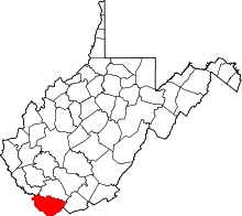 | |
| Towns | ||
| CDPs | ||
| Unincorporated communities |
| |
| Ghost town | ||
| Footnotes | ‡This populated place also has portions in an adjacent county or counties | |
This article is issued from
Wikipedia.
The text is licensed under Creative Commons - Attribution - Sharealike.
Additional terms may apply for the media files.