Sandy Huff, West Virginia
| Sandy Huff | |
|---|---|
| Unincorporated community | |
 Sandy Huff Location within West Virginia  Sandy Huff Sandy Huff (the US) | |
| Coordinates: 37°28′41″N 81°46′30″W / 37.47806°N 81.77500°WCoordinates: 37°28′41″N 81°46′30″W / 37.47806°N 81.77500°W | |
| Country | United States |
| State | West Virginia |
| County | McDowell |
| Elevation | 1,014 ft (309 m) |
| Time zone | UTC-5 (Eastern (EST)) |
| • Summer (DST) | UTC-4 (EDT) |
| Area code(s) | 304 & 681 |
| GNIS feature ID | 1555567[1] |
Sandy Huff is an unincorporated community in McDowell County, West Virginia, United States. Sandy Huff is located on the Tug Fork 2 miles (3.2 km) east-northeast of Iaeger.
References
Municipalities and communities of McDowell County, West Virginia, United States | ||
|---|---|---|
| Cities | 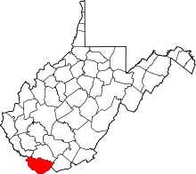 | |
| Towns | ||
| CDPs | ||
| Unincorporated communities |
| |
| Ghost town | ||
| Footnotes | ‡This populated place also has portions in an adjacent county or counties | |
This article is issued from
Wikipedia.
The text is licensed under Creative Commons - Attribution - Sharealike.
Additional terms may apply for the media files.