Lendou-en-Quercy
| Lendou-en-Quercy | |
|---|---|
| Commune | |
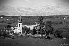 Church and castle of Lolmie | |
 Lendou-en-Quercy Location within Occitanie region  Lendou-en-Quercy | |
| Coordinates: 44°18′31″N 1°15′53″E / 44.3086°N 1.2647°ECoordinates: 44°18′31″N 1°15′53″E / 44.3086°N 1.2647°E | |
| Country | France |
| Region | Occitanie |
| Department | Lot |
| Arrondissement | Cahors |
| Canton | Luzech |
| Intercommunality | Quercy Blanc |
| Government | |
| • Mayor (2018–2020) | Bernard Vignals |
| Area1 | 42.46 km2 (16.39 sq mi) |
| Population (2018)2 | 689 |
| • Density | 16/km2 (42/sq mi) |
| Time zone | UTC+1 (CET) |
| • Summer (DST) | UTC+2 (CEST) |
| INSEE/Postal code | 46262 /46800 |
| Elevation | 127–308 m (417–1,010 ft) |
|
1 French Land Register data, which excludes lakes, ponds, glaciers > 1 km2 (0.386 sq mi or 247 acres) and river estuaries. 2 Population without double counting: residents of multiple communes (e.g., students and military personnel) only counted once. | |
Lendou-en-Quercy is a commune in the department of Lot, southern France. The municipality was established on 1 January 2018 by merger of the former communes of Saint-Cyprien, Saint-Laurent-Lolmie and Lascabanes.[1]
The town hall is located in the village of Saint-Cyprien.
Main sights
- Saint-Laurent church, built in the early 16th century
- The church of Lolmie, slightly modified in the 19th century
See also
References
| Wikimedia Commons has media related to Lendou-en-Quercy. |
- ↑ Arrêté préfectoral 6 December 2017 (in French)
This article is issued from
Wikipedia.
The text is licensed under Creative Commons - Attribution - Sharealike.
Additional terms may apply for the media files.