Lalbenque
| Lalbenque | |
|---|---|
| Commune | |
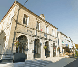 The town hall in Lalbenque | |
 Lalbenque Location within Occitanie region  Lalbenque | |
| Coordinates: 44°20′22″N 1°32′44″E / 44.3394°N 1.5456°ECoordinates: 44°20′22″N 1°32′44″E / 44.3394°N 1.5456°E | |
| Country | France |
| Region | Occitanie |
| Department | Lot |
| Arrondissement | Cahors |
| Canton | Marches du Sud-Quercy |
| Intercommunality | Pays de Lalbenque |
| Government | |
| • Mayor (2001–2008) | Jacques Pouget |
| Area1 | 52.24 km2 (20.17 sq mi) |
| Population (1999)2 | 1,067 |
| • Density | 20/km2 (53/sq mi) |
| Time zone | UTC+1 (CET) |
| • Summer (DST) | UTC+2 (CEST) |
| INSEE/Postal code | 46148 /46230 |
| Elevation |
197–332 m (646–1,089 ft) (avg. 239 m or 784 ft) |
|
1 French Land Register data, which excludes lakes, ponds, glaciers > 1 km2 (0.386 sq mi or 247 acres) and river estuaries. 2 Population without double counting: residents of multiple communes (e.g., students and military personnel) only counted once. | |
Lalbenque is a commune in the Lot department in south-western France.
See also
| Wikimedia Commons has media related to Lalbenque. |
This article is issued from
Wikipedia.
The text is licensed under Creative Commons - Attribution - Sharealike.
Additional terms may apply for the media files.