Bach, Lot
| Bach | |
|---|---|
| Commune | |
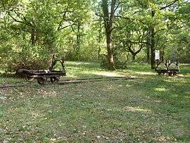 Phosphate mine railway wagons | |
 Bach Location within Occitanie region  Bach | |
| Coordinates: 44°21′05″N 1°40′20″E / 44.3514°N 1.6722°ECoordinates: 44°21′05″N 1°40′20″E / 44.3514°N 1.6722°E | |
| Country | France |
| Region | Occitanie |
| Department | Lot |
| Arrondissement | Cahors |
| Canton | Marches du Sud-Quercy |
| Intercommunality | Pays de Lalbenque |
| Government | |
| • Mayor (2008–2014) | Pierre Burg |
| Area1 | 21.02 km2 (8.12 sq mi) |
| Population (2009)2 | 173 |
| • Density | 8.2/km2 (21/sq mi) |
| Time zone | UTC+1 (CET) |
| • Summer (DST) | UTC+2 (CEST) |
| INSEE/Postal code | 46013 /46230 |
| Elevation | 220–337 m (722–1,106 ft) |
|
1 French Land Register data, which excludes lakes, ponds, glaciers > 1 km2 (0.386 sq mi or 247 acres) and river estuaries. 2 Population without double counting: residents of multiple communes (e.g., students and military personnel) only counted once. | |
Bach is a commune in the Lot department in southwestern France.
Population
| Historical population | ||
|---|---|---|
| Year | Pop. | ±% |
| 1962 | 135 | — |
| 1968 | 144 | +6.7% |
| 1975 | 127 | −11.8% |
| 1982 | 124 | −2.4% |
| 1990 | 140 | +12.9% |
| 1999 | 144 | +2.9% |
| 2006 | 171 | +18.8% |
| 2009 | 173 | +1.2% |
See also
References
| Wikimedia Commons has media related to Bach (Lot). |
This article is issued from
Wikipedia.
The text is licensed under Creative Commons - Attribution - Sharealike.
Additional terms may apply for the media files.