Soturac
| Soturac | |
|---|---|
| Commune | |
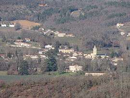 A general view of Soturac | |
 Soturac Location within Occitanie region  Soturac | |
| Coordinates: 44°29′22″N 1°01′03″E / 44.4894°N 1.0175°ECoordinates: 44°29′22″N 1°01′03″E / 44.4894°N 1.0175°E | |
| Country | France |
| Region | Occitanie |
| Department | Lot |
| Arrondissement | Arrondissement of Cahors |
| Canton | Canton of Puy-l'Évêque |
| Intercommunality | Communauté de communes de la Vallée du Lot et du Vignoble |
| Government | |
| • Mayor (2008–2014) | Jacques Laymond |
| Area1 | 19.55 km2 (7.55 sq mi) |
| Population (1999)2 | 670 |
| • Density | 34/km2 (89/sq mi) |
| Time zone | UTC+1 (CET) |
| • Summer (DST) | UTC+2 (CEST) |
| INSEE/Postal code | 46307 /46700 |
| Elevation |
65–234 m (213–768 ft) (avg. 79 m or 259 ft) |
|
1 French Land Register data, which excludes lakes, ponds, glaciers > 1 km2 (0.386 sq mi or 247 acres) and river estuaries. 2 Population without double counting: residents of multiple communes (e.g., students and military personnel) only counted once. | |
Soturac is a commune in the Lot department in south-western France.
See also
| Wikimedia Commons has media related to Soturac. |
This article is issued from
Wikipedia.
The text is licensed under Creative Commons - Attribution - Sharealike.
Additional terms may apply for the media files.