Le Bourg
| Le Bourg | |
|---|---|
| Commune | |
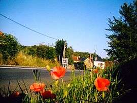 The road into Le Bourg | |
 Le Bourg Location within Occitanie region  Le Bourg | |
| Coordinates: 44°42′36″N 1°54′15″E / 44.71°N 1.9042°ECoordinates: 44°42′36″N 1°54′15″E / 44.71°N 1.9042°E | |
| Country | France |
| Region | Occitanie |
| Department | Lot |
| Arrondissement | Figeac |
| Canton | Lacapelle-Marival |
| Intercommunality | Causse Ségala-Limargue |
| Government | |
| • Mayor (2001–2008) | Christian Faure |
| Area1 | 13.15 km2 (5.08 sq mi) |
| Population (2009)2 | 296 |
| • Density | 23/km2 (58/sq mi) |
| Time zone | UTC+1 (CET) |
| • Summer (DST) | UTC+2 (CEST) |
| INSEE/Postal code | 46034 /46120 |
| Elevation |
336–565 m (1,102–1,854 ft) (avg. 360 m or 1,180 ft) |
|
1 French Land Register data, which excludes lakes, ponds, glaciers > 1 km2 (0.386 sq mi or 247 acres) and river estuaries. 2 Population without double counting: residents of multiple communes (e.g., students and military personnel) only counted once. | |
Le Bourg is a commune in the Lot department in southwestern France.
Population
| Historical population | ||
|---|---|---|
| Year | Pop. | ±% |
| 1962 | 273 | — |
| 1968 | 228 | −16.5% |
| 1975 | 218 | −4.4% |
| 1982 | 222 | +1.8% |
| 1990 | 229 | +3.2% |
| 1999 | 246 | +7.4% |
| 2009 | 296 | +20.3% |
See also
References
| Wikimedia Commons has media related to Le Bourg. |
This article is issued from
Wikipedia.
The text is licensed under Creative Commons - Attribution - Sharealike.
Additional terms may apply for the media files.