Saint-Denis-lès-Martel
| Saint-Denis-lès-Martel | |
|---|---|
| Commune | |
 Saint-Denis-lès-Martel Location within Occitanie region  Saint-Denis-lès-Martel | |
| Coordinates: 44°56′30″N 1°39′45″E / 44.9417°N 1.6625°ECoordinates: 44°56′30″N 1°39′45″E / 44.9417°N 1.6625°E | |
| Country | France |
| Region | Occitanie |
| Department | Lot |
| Arrondissement | Gourdon |
| Canton | Martel |
| Intercommunality | Pays de Martel |
| Government | |
| • Mayor (2014–2020) | Guy Mispoulet |
| Area1 | 7.93 km2 (3.06 sq mi) |
| Population (1999)2 | 362 |
| • Density | 46/km2 (120/sq mi) |
| Time zone | UTC+1 (CET) |
| • Summer (DST) | UTC+2 (CEST) |
| INSEE/Postal code | 46265 /46600 |
| Elevation |
93–323 m (305–1,060 ft) (avg. 120 m or 390 ft) |
|
1 French Land Register data, which excludes lakes, ponds, glaciers > 1 km2 (0.386 sq mi or 247 acres) and river estuaries. 2 Population without double counting: residents of multiple communes (e.g., students and military personnel) only counted once. | |
Saint-Denis-lès-Martel is a commune in the Lot department in south-western France.
Geography
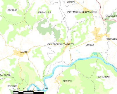
The commune of Saint-Denis-lès-Martel is located in Quercy, in the Causse de Martel. It is watered by two tributaries of the Dordogne, the Sourdoire which borders the communal territory to the southeast, and the Tourmente.
Neighbouring municipalities
Saint-Denis-lès-Martel is adjacent to five other communes.
Places adjacent to Saint-Denis-lès-Martel | ||||||||||
|---|---|---|---|---|---|---|---|---|---|---|
| ||||||||||
Toponymy
The toponym Saint-Denis-lès-Martel, in Occitan Sent Daunís, is based on the Christian Hagiotoponyme, Denis de Paris (Dionysius): first Bishop of Paris. Lès comes from Lez, a preposition from the late Latin latus meaning next to.
Sent Daunís was called first Lenzac variant of Lanzac.
During the French Revolution, the commune, then simply named Saint-Denis, bears the name of Seu-Denis. The appendix lès-Martel was added to the name of the municipality in 1890.
Its inhabitants are called the Saint-Dyonésiens.
History
It is on the present territory of Saint-Denis-lès-Martel, on the slopes of the puy d'Issolud formerly Uxellodunum, the last battle of the conquest of Gaul by Julius Caesar during the summer of 51 B.C. after the shocks of Gergovie and Alésia in 52 B.C.. This ultimate victory, that marked the beginning of the Roman occupation of all Gaul, was acquired by a ruse by Caesar who managed to deprive the besieged of Uxellodunum by his legionaries, by digging underground galleries that managed to deprive the beleaguered of their main water supply (current fountain of Loulié) of this Gallic oppidum in the land of the Cadurques.
On April 26, 2001, the work of the team of the archaeologist J.P. Girault was officially recognised by the Ministry of Culture in Toulouse, identifying Uxellodunum with the puy d'Issolud located in the Lot on the right bank of the Dordogne river in the commune of Vayrac and partly in that of Saint-Denis-lès-Martel, source of the Fountain of Loulié, place of the siege and the capture of the source by the Romans.
Local culture and heritage
Places and monuments
.jpg)
- Church.
- Archaeological Site of the fountain of l'Oulié, registered on 29 November 2010 under the title of Historic Monument.
- The railway station is called Saint-Denis-près-Martel.
- The Eiffel bridge connecting Saint-Denis-près-Martel to Capdenac and Rodez by train.
See also
References
| Wikimedia Commons has media related to Saint-Denis-lès-Martel. |