Saint-Pierre-Lafeuille
| Saint-Pierre-Lafeuille | |
|---|---|
| Commune | |
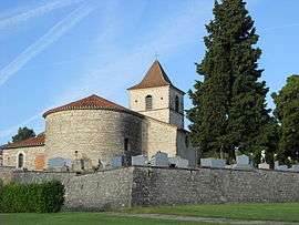 The church in Saint-Pierre-Lafeuille | |
 Saint-Pierre-Lafeuille Location within Occitanie region  Saint-Pierre-Lafeuille | |
| Coordinates: 44°31′28″N 1°27′16″E / 44.5244°N 1.4544°ECoordinates: 44°31′28″N 1°27′16″E / 44.5244°N 1.4544°E | |
| Country | France |
| Region | Occitanie |
| Department | Lot |
| Arrondissement | Cahors |
| Canton | Causse et Bouriane |
| Intercommunality | Catus |
| Government | |
| • Mayor (2008–2014) | Joël Gilbert |
| Area1 | 8.52 km2 (3.29 sq mi) |
| Population (1999)2 | 292 |
| • Density | 34/km2 (89/sq mi) |
| Time zone | UTC+1 (CET) |
| • Summer (DST) | UTC+2 (CEST) |
| INSEE/Postal code | 46340 /46090 |
| Elevation |
154–361 m (505–1,184 ft) (avg. 300 m or 980 ft) |
|
1 French Land Register data, which excludes lakes, ponds, glaciers > 1 km2 (0.386 sq mi or 247 acres) and river estuaries. 2 Population without double counting: residents of multiple communes (e.g., students and military personnel) only counted once. | |
Saint-Pierre-Lafeuille is a commune in the Lot department in south-western France.
See also
References
| Wikimedia Commons has media related to Saint-Pierre-Lafeuille. |
This article is issued from
Wikipedia.
The text is licensed under Creative Commons - Attribution - Sharealike.
Additional terms may apply for the media files.