Lhospitalet
| Lhospitalet | |
|---|---|
| Commune | |
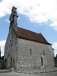 The church in Lhospitalet | |
 Lhospitalet Location within Occitanie region  Lhospitalet | |
| Coordinates: 44°21′43″N 1°24′32″E / 44.3619°N 1.4089°ECoordinates: 44°21′43″N 1°24′32″E / 44.3619°N 1.4089°E | |
| Country | France |
| Region | Occitanie |
| Department | Lot |
| Arrondissement | Cahors |
| Canton | Marches du Sud-Quercy |
| Intercommunality | Communauté de communes de Castelnau-Montratier |
| Government | |
| • Mayor (2001–2008) | Jean-Claude Bessou |
| Area1 | 14.65 km2 (5.66 sq mi) |
| Population (2006)2 | 441 |
| • Density | 30/km2 (78/sq mi) |
| Time zone | UTC+1 (CET) |
| • Summer (DST) | UTC+2 (CEST) |
| INSEE/Postal code | 46172 /46170 |
| Elevation | 217–330 m (712–1,083 ft) |
|
1 French Land Register data, which excludes lakes, ponds, glaciers > 1 km2 (0.386 sq mi or 247 acres) and river estuaries. 2 Population without double counting: residents of multiple communes (e.g., students and military personnel) only counted once. | |
Lhospitalet is a commune in the Lot department in south-western France.
Geography
The Barguelonne forms part of the commune's southern border.
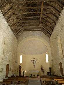
Church
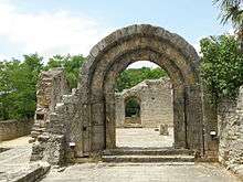
Ruins of the old Hospital
See also
| Wikimedia Commons has media related to Lhospitalet. |
This article is issued from
Wikipedia.
The text is licensed under Creative Commons - Attribution - Sharealike.
Additional terms may apply for the media files.