Bagnac-sur-Célé
| Bagnac-sur-Célé | |
|---|---|
| Commune | |
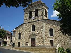 The church in Bagnac-sur-Célé | |
 Bagnac-sur-Célé Location within Occitanie region  Bagnac-sur-Célé | |
| Coordinates: 44°40′02″N 2°09′33″E / 44.6672°N 2.1592°ECoordinates: 44°40′02″N 2°09′33″E / 44.6672°N 2.1592°E | |
| Country | France |
| Region | Occitanie |
| Department | Lot |
| Arrondissement | Figeac |
| Canton | Figeac-2 |
| Intercommunality | Figeac-Communauté |
| Government | |
| • Mayor (2008–2014) | Fausto Araqué |
| Area1 | 22.29 km2 (8.61 sq mi) |
| Population (2009)2 | 1,562 |
| • Density | 70/km2 (180/sq mi) |
| Time zone | UTC+1 (CET) |
| • Summer (DST) | UTC+2 (CEST) |
| INSEE/Postal code | 46015 /46270 |
| Elevation |
210–478 m (689–1,568 ft) (avg. 234 m or 768 ft) |
|
1 French Land Register data, which excludes lakes, ponds, glaciers > 1 km2 (0.386 sq mi or 247 acres) and river estuaries. 2 Population without double counting: residents of multiple communes (e.g., students and military personnel) only counted once. | |
Bagnac-sur-Célé (Occitan: Banhac) is a commune in the Lot department in southwestern France.
Population
| Historical population | ||
|---|---|---|
| Year | Pop. | ±% |
| 1962 | 1,580 | — |
| 1968 | 1,670 | +5.7% |
| 1975 | 1,691 | +1.3% |
| 1982 | 1,724 | +2.0% |
| 1990 | 1,582 | −8.2% |
| 1999 | 1,519 | −4.0% |
| 2006 | 1,551 | +2.1% |
| 2009 | 1,562 | +0.7% |
See also
References
| Wikimedia Commons has media related to Bagnac-sur-Célé. |
This article is issued from
Wikipedia.
The text is licensed under Creative Commons - Attribution - Sharealike.
Additional terms may apply for the media files.