Dégagnac
| Dégagnac | |
|---|---|
| Commune | |
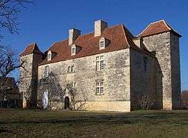 The Château de Lantis, in Dégagnac | |
 Dégagnac Location within Occitanie region  Dégagnac | |
| Coordinates: 44°39′57″N 1°19′00″E / 44.6658°N 1.3167°ECoordinates: 44°39′57″N 1°19′00″E / 44.6658°N 1.3167°E | |
| Country | France |
| Region | Occitanie |
| Department | Lot |
| Arrondissement | Gourdon |
| Canton | Gourdon |
| Intercommunality | Communauté de communes du Pays de Salviac |
| Government | |
| • Mayor (2001–2008) | Madeleine Blanc |
| Area1 | 37.9 km2 (14.6 sq mi) |
| Population (1999)2 | 507 |
| • Density | 13/km2 (35/sq mi) |
| Time zone | UTC+1 (CET) |
| • Summer (DST) | UTC+2 (CEST) |
| INSEE/Postal code | 46087 /46340 |
| Elevation |
140–306 m (459–1,004 ft) (avg. 185 m or 607 ft) |
|
1 French Land Register data, which excludes lakes, ponds, glaciers > 1 km2 (0.386 sq mi or 247 acres) and river estuaries. 2 Population without double counting: residents of multiple communes (e.g., students and military personnel) only counted once. | |
Dégagnac is a commune in the Lot department in south-western France.
Geography
The river Céou forms all of the commune's north-eastern border.
See also
| Wikimedia Commons has media related to Dégagnac. |
This article is issued from
Wikipedia.
The text is licensed under Creative Commons - Attribution - Sharealike.
Additional terms may apply for the media files.