Saux
| Saux | |
|---|---|
| Commune | |
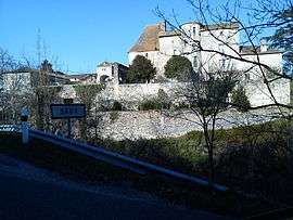 The Chateau of Saux | |
 Saux Location within Occitanie region  Saux | |
| Coordinates: 44°23′27″N 1°05′10″E / 44.3908°N 1.0861°ECoordinates: 44°23′27″N 1°05′10″E / 44.3908°N 1.0861°E | |
| Country | France |
| Region | Occitanie |
| Department | Lot |
| Arrondissement | Cahors |
| Canton | Puy-l'Évêque |
| Intercommunality | Communauté de communes du Canton de Montcuq |
| Government | |
| • Mayor (2001–2008) | Jeanine Ausset |
| Area1 | 8.31 km2 (3.21 sq mi) |
| Population (1999)2 | 133 |
| • Density | 16/km2 (41/sq mi) |
| Time zone | UTC+1 (CET) |
| • Summer (DST) | UTC+2 (CEST) |
| INSEE/Postal code | 46300 /46800 |
| Elevation |
173–275 m (568–902 ft) (avg. 242 m or 794 ft) |
|
1 French Land Register data, which excludes lakes, ponds, glaciers > 1 km2 (0.386 sq mi or 247 acres) and river estuaries. 2 Population without double counting: residents of multiple communes (e.g., students and military personnel) only counted once. | |
Saux (pronounced "Sox") is a commune in the Lot department in south-western France.
See also
| Wikimedia Commons has media related to Saux. |
This article is issued from
Wikipedia.
The text is licensed under Creative Commons - Attribution - Sharealike.
Additional terms may apply for the media files.