Cras, Lot
| Cras | |
|---|---|
| Commune | |
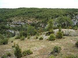 On the site of the oppidum of Murcens | |
 Cras Location within Occitanie region  Cras | |
| Coordinates: 44°34′07″N 1°32′02″E / 44.5686°N 1.5339°ECoordinates: 44°34′07″N 1°32′02″E / 44.5686°N 1.5339°E | |
| Country | France |
| Region | Occitanie |
| Department | Lot |
| Arrondissement | Gourdon |
| Canton | Causse et Vallées |
| Intercommunality | Communauté de communes Lot-Célé |
| Government | |
| • Mayor (2001–2008) | Michel Bonhomme |
| Area1 | 10.22 km2 (3.95 sq mi) |
| Population (1999)2 | 70 |
| • Density | 6.8/km2 (18/sq mi) |
| Time zone | UTC+1 (CET) |
| • Summer (DST) | UTC+2 (CEST) |
| INSEE/Postal code | 46079 /46360 |
| Elevation |
170–383 m (558–1,257 ft) (avg. 317 m or 1,040 ft) |
|
1 French Land Register data, which excludes lakes, ponds, glaciers > 1 km2 (0.386 sq mi or 247 acres) and river estuaries. 2 Population without double counting: residents of multiple communes (e.g., students and military personnel) only counted once. | |
Cras is a commune in the Lot department in south-western France.
See also
| Wikimedia Commons has media related to Cras (Lot). |
This article is issued from
Wikipedia.
The text is licensed under Creative Commons - Attribution - Sharealike.
Additional terms may apply for the media files.