Saint-Martin-de-Vers
| Saint-Martin-de-Vers | |
|---|---|
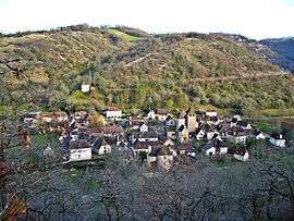 A general view of Saint-Martin-de-Vers | |
 Saint-Martin-de-Vers Location within Occitanie region  Saint-Martin-de-Vers | |
| Coordinates: 44°34′54″N 1°33′34″E / 44.5817°N 1.5594°ECoordinates: 44°34′54″N 1°33′34″E / 44.5817°N 1.5594°E | |
| Country | France |
| Region | Occitanie |
| Department | Lot |
| Arrondissement | Cahors |
| Canton | Causse et Vallées |
| Government | |
| • Mayor (2001–2014) | Luc Faurie-Grépon |
| Area1 | 9.93 km2 (3.83 sq mi) |
| Population (1999)2 | 105 |
| • Density | 11/km2 (27/sq mi) |
| Time zone | UTC+1 (CET) |
| • Summer (DST) | UTC+2 (CEST) |
| INSEE/Postal code | 46275 /46360 |
| Elevation |
190–423 m (623–1,388 ft) (avg. 365 m or 1,198 ft) |
|
1 French Land Register data, which excludes lakes, ponds, glaciers > 1 km2 (0.386 sq mi or 247 acres) and river estuaries. 2 Population without double counting: residents of multiple communes (e.g., students and military personnel) only counted once. | |
Saint-Martin-de-Vers is a former commune in the Lot department in south-western France. On 1 January 2016, it was merged into the new commune of Les Pechs-du-Vers.[1]
See also
References
- ↑ Arrêté préfectoral 29 December 2015
| Wikimedia Commons has media related to Saint-Martin-de-Vers. |
This article is issued from
Wikipedia.
The text is licensed under Creative Commons - Attribution - Sharealike.
Additional terms may apply for the media files.