Capdenac
| Capdenac | ||
|---|---|---|
| Commune | ||
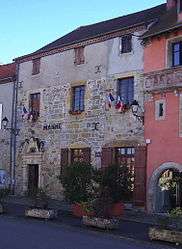 The town hall in Capdenac | ||
| ||
 Capdenac Location within Occitanie region  Capdenac | ||
| Coordinates: 44°34′54″N 2°04′12″E / 44.5817°N 2.07°ECoordinates: 44°34′54″N 2°04′12″E / 44.5817°N 2.07°E | ||
| Country | France | |
| Region | Occitanie | |
| Department | Lot | |
| Arrondissement | Figeac | |
| Canton | Figeac-2 | |
| Intercommunality | Communauté de communes Figeac-Communauté | |
| Government | ||
| • Mayor (2008–2014) | Guy Batherosse | |
| Area1 | 10.90 km2 (4.21 sq mi) | |
| Population (2006)2 | 1,062 | |
| • Density | 97/km2 (250/sq mi) | |
| Time zone | UTC+1 (CET) | |
| • Summer (DST) | UTC+2 (CEST) | |
| INSEE/Postal code | 46055 /46100 | |
| Elevation |
155–369 m (509–1,211 ft) (avg. 298 m or 978 ft) | |
|
1 French Land Register data, which excludes lakes, ponds, glaciers > 1 km2 (0.386 sq mi or 247 acres) and river estuaries. 2 Population without double counting: residents of multiple communes (e.g., students and military personnel) only counted once. | ||
.svg.png)
Capdenac is a commune in the Lot department in south-western France.
It has been inhabited since prehistoric times. At one time Capdenac was thought to be identifiable as the Gaulish settlement of Uxellodunum which was besieged by Julius Caesar, but this theory has been discredited.
See also
| Wikimedia Commons has media related to Capdenac. |
This article is issued from
Wikipedia.
The text is licensed under Creative Commons - Attribution - Sharealike.
Additional terms may apply for the media files.