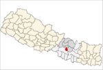
Lalitpur District, Nepal
| Lalitpur District ललितपुर जिल्ला | |
|---|---|
| District | |
| Country | Nepal |
| Admin HQ. | Lalitpur |
| Government | |
| • Type | Coordination committee |
| • Body | DCC, Lalitpur |
| Area | |
| • Total | 350 km2 (140 sq mi) |
| Population (2011) | |
| • Total | 468,132 [1][2] |
|
2001 pop.: 337,785 1991 pop.: 257,086 1991 pop.: 184,341 | |
| Time zone | UTC+5:45 (NPT) |
| Website |
www |
Lalitpur District (Nepali: ललितपुर जिल्ला![]()
Geography and Climate
| Climate Zone[4] | Elevation Range | % of Area |
|---|---|---|
| Upper Tropical | 300 to 1,000 meters 1,000 to 3,300 ft. |
9.9% |
| Subtropical | 1,000 to 2,000 meters 3,300 to 6,600 ft. |
79.3% |
| Temperate | 2,000 to 3,000 meters 6,400 to 9,800 ft. |
10.8% |
Administrative division
There are six municipalies in Lalitpur District, including three Rural Municipalities and one Metropolitan city:
- Lalitpur Metropolitan City
- Mahalaxmi Municipality
- Godawari Municipality
- Konjyoson Rural Municipality
- Bagmati Rural Municipality
- Mahankal Rural Municipality
Former Village Development Committees
Prior to federal restructuring, the following Village development committees were also part of the district. By 2017, they were all merged into municipalities or rural municipalities or were included into Lalitpur Metropolitan City.
- Ashrang
- Badikhel, now Godawari Municipality
- Bhardev
- Bhattedanda
- Bisankhunarayan, now Godawari Municipality
- Bukhel
- Bhainsapti,now Karyabinayak Municipality
- Chandanpur
- Chapagaun, now Bajrabarahi Municipality
- Chaughare
- Chhampi, now Karyabinayak Municipality
- Dalchoki
- Devichaur
- Dhapakhel, now Lalitpur Municipality
- Dukuchhap, now Karyabinayak Municipality
- Ghusel
- Gimdi
- Godamchaur, now Godawari Municipality
- Godawari, now Godawari Municipality
- Gotikhel
- Harisiddhi, now Lalitpur Municipality
- Ikudol
- Imadol, now Mahalakshmi Municipality
- Jharuwarasi, now Bajrabarahi Municipality
- Kaleshwar
- Khokana, now Karyabinayak Municipality
- Lamatar, now Mahalakshmi Municipality
- Lele, now Bajrabarahi Municipality
- Lubhu, now Mahalakshmi Municipality
- Malta
- Manikhel
- Nallu
- Pyutar
- Sainbu, now Karyabinayak Municipality
- Sankhu
- Siddhipur, now Mahalakshmi Municipality
- Sunakothi, now Lalitpur Municipality
- Thaiba, now Godawari Municipality
- Thecho, now Bajrabarahi Municipality
- Thuladurlung
- Tikathali, now Mahalakshmi Municipality
Other places
- Jharuwarasi
- Chyasal
- Jawalakhel
- Pyan Gaun
- Lagankhel
- Jhamsikhel
- Kumaripati
- Kupondole
Education
Lalitpur District has adequate education facilities in comparison to other districts, including:
- Adarsha Vidya Mandir (AVM)
- Graded English Medium School (GEMS)
- Annal Jyoti Boarding School (AJS)
- Ideal Model School
- Institute of Engineering (Pulchok)
- Little Angels' School
- Little Learners Fun School (Saibu Bhaisepati)
- Rato Bangala school
- St. Mary's School
- St. Xavier's School
- Nepal Don Bosco School, Siddhipur
- Shuvatara School
- Vajra Academy (Jharuwarashi)
- Institute of Sexual Arts
- Kilestone School
- Anant English School, Siddhipur
- The Sudesha School (Nakhkhu)
- Pawan Prakriti English Secondary school (tikathali)
- Pathshala Nepal Foundation (bagdol)
Sports
Lalitpur is also home to several notable sporting organisations and grounds such as:
- ANFA Complex, Satdobato
- Tennis Complex, Satdobato
- Army Physical Training Centre, Lagankhel
- Chyasal Technical Centre, Chyasal
- Thecho Badminton Club
References
- ↑ "National Planning Commission Secretariat, Central Bureau of Statistics. Nepal". Archived from the original on 2016-08-16.
- ↑ "STATISTICAL YEAR BOOK OF NEPAL - 2011" (PDF).
- ↑ http://census.gov.np/images/pdf/Preliminary%20Leaflet%202011.pdf%5Bpermanent+dead+link%5D
- ↑ The Map of Potential Vegetation of Nepal - a forestry/agroecological/biodiversity classification system (PDF), . Forest & Landscape Development and Environment Series 2-2005 and CFC-TIS Document Series No.110., 2005, ISBN 87-7903-210-9, retrieved Nov 22, 2013
- "Districts of Nepal". Statoids.
External links
| Wikimedia Commons has media related to Lalitpur District, Nepal. |
| Province No. 1 |  | |
|---|---|---|
| Province No. 2 | ||
| Province No. 3 | ||
| Gandaki Pradesh | ||
| Province No. 5 | ||
| Karnali Pradesh | ||
| Sudurpashchim Pradesh | ||
Coordinates: 27°40′N 85°19′E / 27.667°N 85.317°E