Fort Spring, West Virginia
| Fort Spring, West Virginia | |
|---|---|
| Unincorporated community | |
 Fort Spring  Fort Spring | |
| Coordinates: 37°44′42″N 80°32′21″W / 37.74500°N 80.53917°WCoordinates: 37°44′42″N 80°32′21″W / 37.74500°N 80.53917°W | |
| Country | United States |
| State | West Virginia |
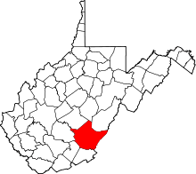
| County | Greenbrier |
| Elevation | 1,637 ft (499 m) |
| Time zone | UTC-5 (Eastern (EST)) |
| • Summer (DST) | UTC-4 (EDT) |
| GNIS feature ID | 1539161[1] |
Fort Spring is an unincorporated community and coal town in Greenbrier County, West Virginia, USA. It is situated along the Greenbrier River within the Greenbrier River Watershed. It was once a substantial portion of the Chesapeake and Ohio railway by way of the Gravel Girtie route from Hinton in Summers County, West Virginia to Clifton Forge in Virginia. The name comes from its main export; Mississippian limestone from Snowflake Quarry sent to Clifton Forge, Virginia The main road going through the small town was once the original rail line, but was moved.
Fort Spring was originally called "Mann's Ferry" and the community's current name refers to the old settler fort that has been lost to history. The rock cliff, or bluff, seen just prior to the primary two train tunnels when traveling eastward, was named 'Wilson's Bluff' due to a family settled there. Colonel John Stuart, who shipped Ice Age sloth bones (Megalonyx jeffersonii) to Thomas Jefferson, noted the presence of saltpetre caves in the area. The area is a combination of karst topography, riparian floodplain and ancient riverbeds with limestone (karst) outcropping mixing with farmlands and deciduous forest. The only available drinking water is by drilled wells or cistern or transportation.
Thanks to recent West Virginia tourism promotions, Fort Spring is a known spot for setting down kayaks and other types of boats for day trips to the nearby town of Alderson.
See also
Sources
- Jones, William K. "The Karst Hydrology Atlas of West Virginia
- Jones, William K. "Hydrology of Limestone Karst." 1973
- McCue, J. B., Lucke, and Woodward, H.P., 1939, WVGES
- "Greenbrier County" 1939 United States Geological Survey
- "What is this Thing, Thomas Jefferson?" Wilson, Marcia 2005 Unpublished Thesis
References
- ↑ "US Board on Geographic Names". United States Geological Survey. 2007-10-25. Retrieved 2008-01-31.